

People on bikes and scooters finally have a separated connection from one end of the Seattle waterfront to the other, after the Office of the Waterfront opened the final segment of the long-anticipated central waterfront bike path in time for a celebration Saturday. The two-way bike lane is one of the last pieces to fall into place before the $806 million waterfront revamp fully wraps up later this year.
While work continues on some key connections that will more fully tie in the waterfront path with the broader city bike network, the new facility will undoubtedly become a major spine for bike travel. The waterfront has been without a dedicated bike lane since demolition of the Alaskan Way Viaduct started in 2019 — that old lane, squeezed under the elevated highway next to parked cars, was a far cry from the facility that opens this weekend. Fully integrated into the waterfront’s new artwork near the state ferry terminal, the lane is already becoming one of the most photogenic parts of the new promenade and gathering space.
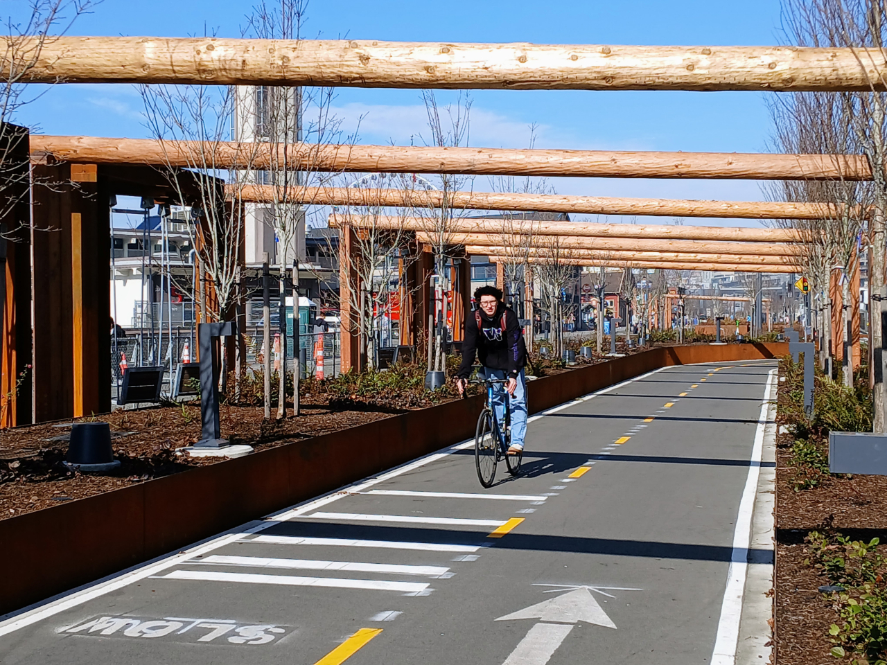
Let’s get the gripes out of the way. Two years ago, as the new facility was finally taking shape, The Urbanist dug into the long history leading to this point, and the design compromises that many urban design advocates will likely lament for some time. Promised as a 12-foot path from end to end, a minimum design standard for a two-way bike path, designers at the city’s Office of the Waterfront ultimately shaved entire feet off the facility by counting shoulders as part of that width. That’s not standard practice, and would never hold water if it were a traffic lane instead of a bike facility.

In some sections, the metal barriers for the planters are also at pedal-strike height, another design no-no for safe bike facilities. This creates a risk for riders who are either squeezed to the edge due to the narrowness of the facility or not paying attention; if their pedal strikes the barrier with enough force, they could be sent to the ground. The metal barrier would then become an added hazard to a falling person.
Councilmember Bob Kettle recently brought up this issue with the City’s chief transportation safety officer Venu Nemani, who said he was not aware of the issue. This exchange underscored the degree to which the Office of the Waterfront planned the facility in a silo, outside of the normal checks and balances provided with projects in the Seattle Department of Transportation’s portfolio.
Office of Waterfront illustrations earlier in the design process also de-emphasized the myriad of twists and turns to accommodate bulb-outs for parking along the western edge of Alaskan Way, which led to frustration from advocates who were expecting a straighter path. In 2023, the agency sought to justify the twisty path as traffic calming intended to slow people on bikes through busy pedestrian areas. But, as many noted, the nearby Alaskan Way — which widens out south of Columbia Street to eight car lanes — includes no such calming infrastructure.
And while many of these design decisions will likely turn into real-life limitations as bike and scooter volumes continue to increase on the waterfront, the grand opening of one of Seattle’s flagship bike corridors is a milestone worth celebrating. The waterfront has been a daunting place to decide to ride a bike, especially for a tourist or infrequent rider, but now it will likely turn into one of the most obvious places to try out Seattle’s bike network.

While a majority of the bike lane has been open for a few weeks, a new segment opening this weekend is the eye-catching connection between the path under the Overlook Walk and the northern segment of Alaskan Way into Belltown. What’s likely the most protected bike lane in the city (or the country?) this connection features high walls along either side. Eventually riders will have a choice of two separate pathways to connect further north to the Elliott Bay trail.

At the top of Elliott Way, riders heading into Belltown will see upgraded bike lanes along Bell Street when they’re completed later this year, though a gap between First and Second Avenue is set to remain. On the south end, construction on a two-block bike lane along Yesler Way to connect to Second Avenue is set to start construction soon.
Saturday’s celebration of the new bike lane, featuring speakers from the City of Seattle along with Cascade Bicycle Club and Seattle Neighborhood Greenways, starts with a 10:30am with a ribbon-cutting ceremony to follow.

Ryan Packer has been writing for The Urbanist since 2015, and currently reports full-time as Contributing Editor. Their beats are transportation, land use, public space, traffic safety, and obscure community meetings. Packer has also reported for other regional outlets including Capitol Hill Seattle, BikePortland, Seattle Met, and PubliCola. They live in the Capitol Hill neighborhood of Seattle.