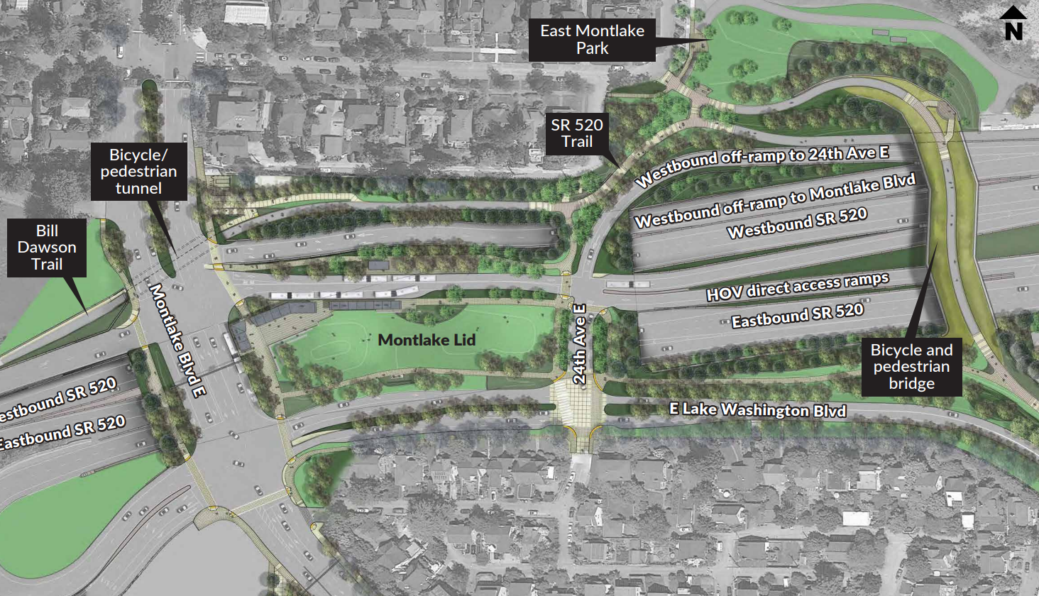
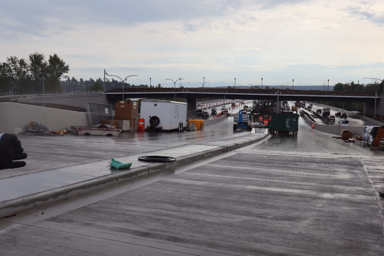
After years of construction, the Washington State Department of Transportation (WSDOT) is weeks away from opening its highway lid over State Route 520 in Montlake, which includes a slew of brand new bike, pedestrian, and transit connections. The new infrastructure, which includes a bike and pedestrian bridge and tunnel in addition to the lid itself, will forever transform how people get around the area and access the highly used 520 Trail across Lake Washington.
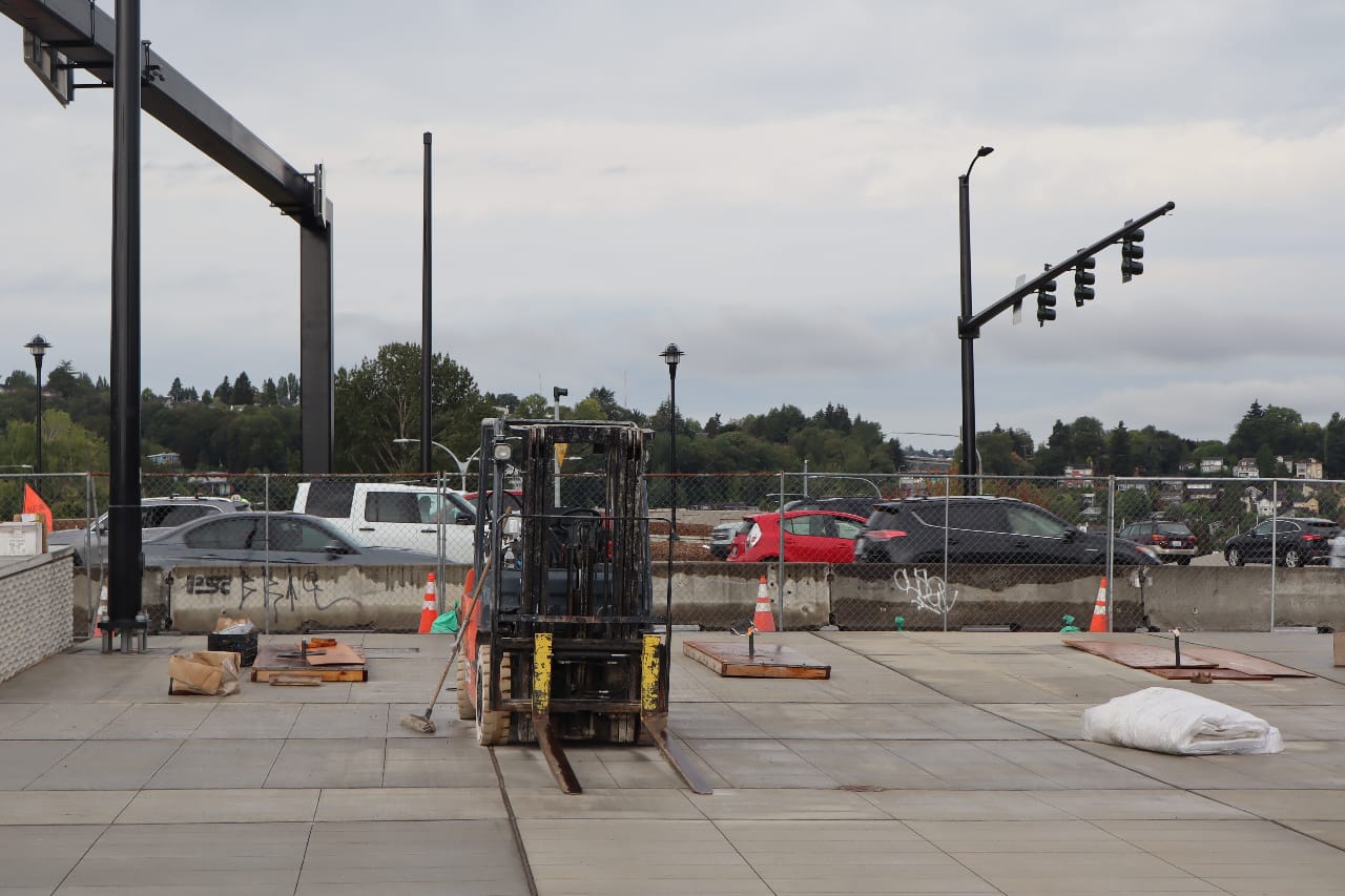
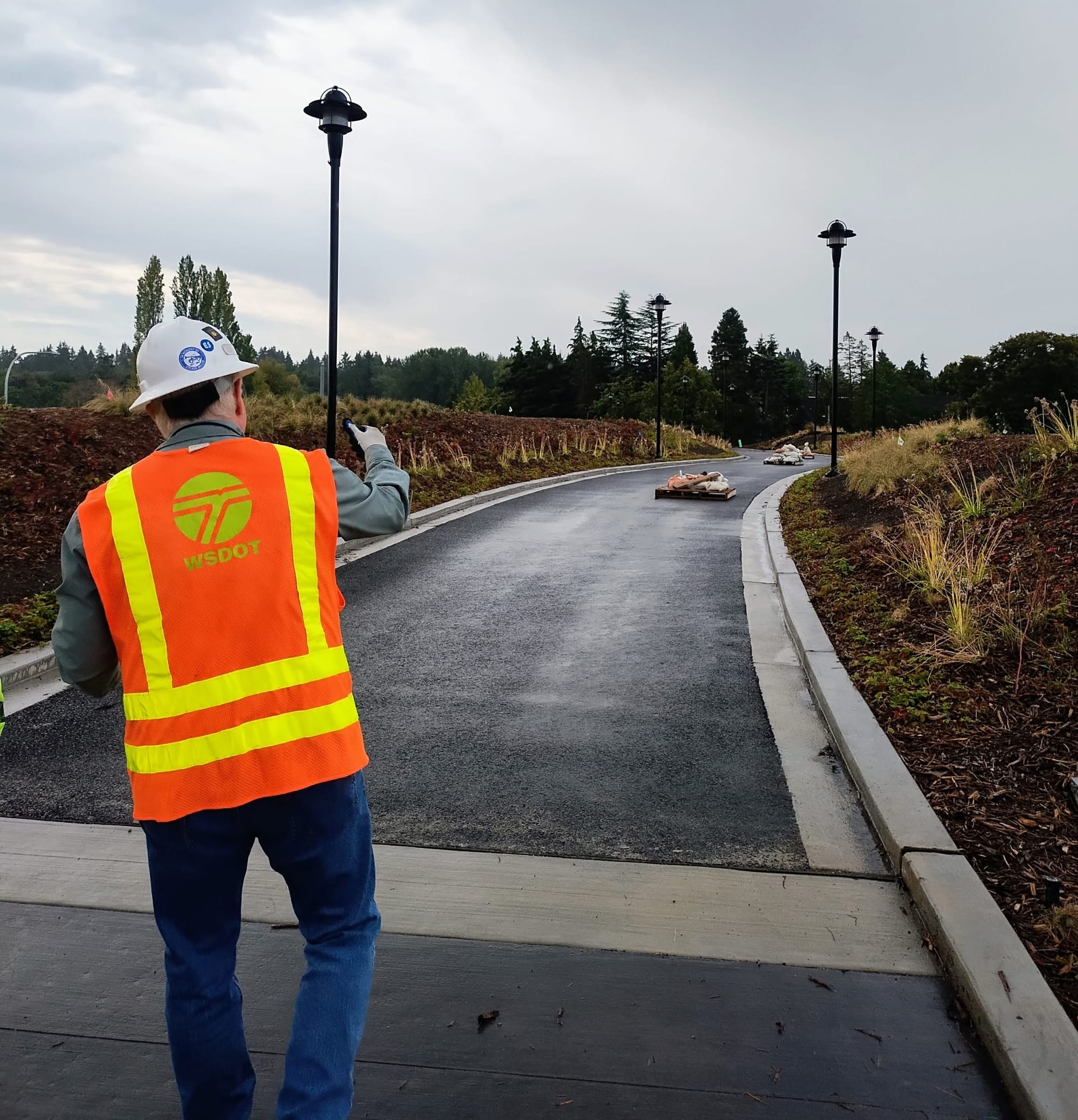
This week, WSDOT let The Urbanist behind the fences for a sneak peek at how things are progressing, as work crews finish creating the final path connections, adding greenery and moving earth to get things ready for public use. While much is left to be done, the essential infrastructure is in place, and the difference was clear for cyclists, pedestrians, and transit riders, who will navigate a true multimodal hub rather than a forlorn highway interchange.
The exact opening date for these new elements remains up in the air for now. Everything is tied together, and some pieces have been delayed, most notably the transit canopies that will keep riders dry at bus stops when it’s raining. Much is dependent on when WSDOT decides to open the direct access ramps for transit vehicles and HOV drivers, an action that will split today’s continuous work zone in two.
All of the pieces are interconnected, precluding a phased opening for different elements, the department said. At the tour, WSDOT spokesperson Steve Peer confirmed that it’s looking like everything will be open by Halloween, though that timeline could definitely shift in the coming weeks.
The Lid
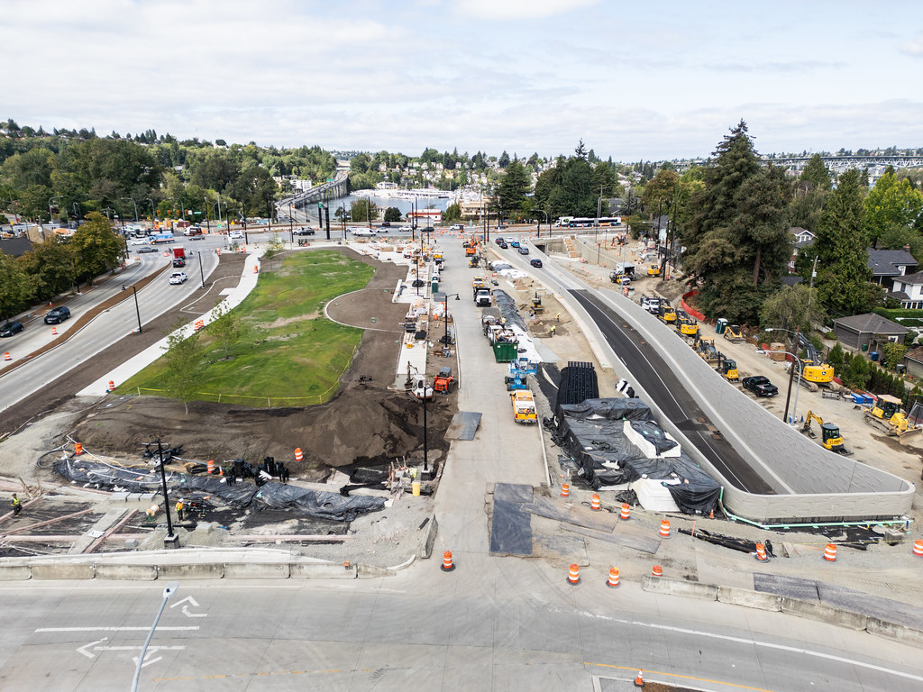
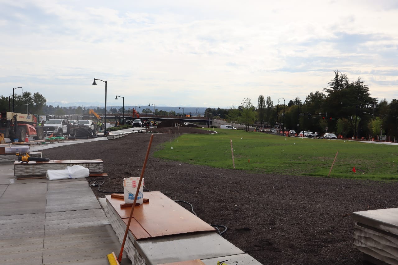
If you’ve walked or biked on the temporary pathway along Montlake Boulevard over the past few months, you’ve seen the blocks of “geofoam” placed on top of the base structure of the lid transform into dirt and grass. Concrete pathways are now in place that will provide a buffer from nine-lane Montlake Boulevard and allow pedestrians and cyclists to connect between bus stops, the 520 Trail, and local streets.
It remains to be seen whether the grass will truly transform the new lid into a space for picnickers and sunbathers or into a new habitat for Canada geese. But it will provide a nice sound buffer from highway noise and sets a new bar for mitigating Washington’s urban highways moving forward. The Roanoke Lid set to take shape in North Capitol Hill will likely function more like an urban park, but the Montlake Lid will certainly prove a valuable piece of infrastructure that will represent a small step toward stitching the street grid back together.
Buses haven’t directly served the 520/Montlake Boulevard interchange since 2019, when the “Montlake Flyer” stop that buses used to let passengers off right along the highway closed. This fall, the direct HOV and transit ramps will open and buses will be able to start serving the transit center built into the Montlake Lid. Supply issues getting the transit shelter canopies delivered mean that they will be one of the last elements to go in before the lid opens, and they’re playing a role in setting a date for its opening.
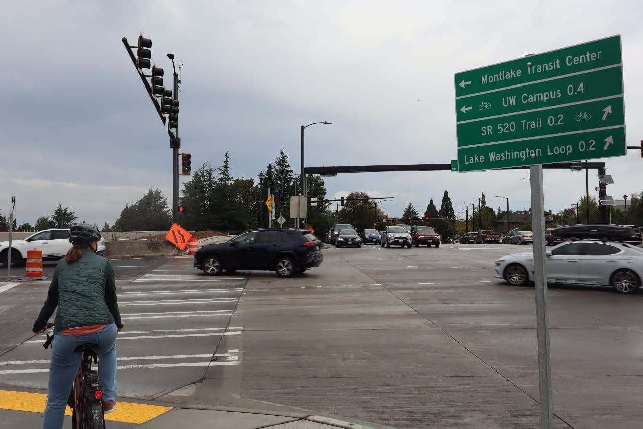
When the direct access ramps open, buses that are headed toward UW, like the 255, 542, and 556 will be able to stop at the Montlake Lid, allowing passengers to make direct connections to northbound buses. Unfortunately, the connection to southbound buses like the 48 will remain a bit of a walk away from the lid, down at Roanoke Street. While buses like the 545 headed to Downtown Seattle should be able to briefly exit the highway and stop in Montlake, the signal configuration (controlled by the Seattle Department of Transportation) isn’t being set up to allow that, WSDOT officials told The Urbanist.
Long term, the number of buses that would utilize that movement will decrease after the full 2 Line starts light rail service across I-90, but it’s an obvious benefit for transit riders that’s been left on the table.
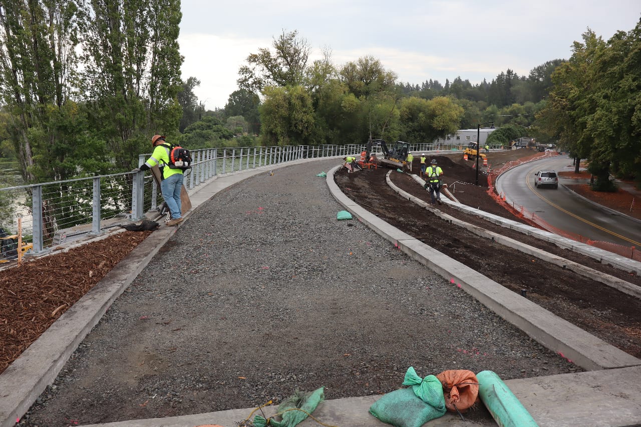
The Bike and Pedestrian Bridge
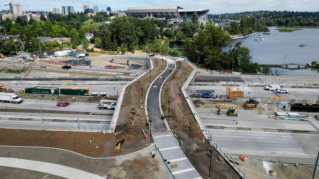
More than the Montlake Lid, the most significant piece of infrastructure set to open this fall is the new pedestrian and bike bridge just east of the lid. People who normally use Montlake Boulevard to access the 520 Trail or to cross the Montlake Bridge will have a much more appealing option here, with a 70-foot-wide bridge essentially functioning as a mini lid itself.
The most common connection for anyone using the bridge will be Lake Washington Boulevard toward the Washington Arboretum, with a very wide pathway being built to bring users down to street level in that direction. Unfortunately, until the Seattle Parks project set to transform the north portion of the arboretum is completed, there won’t be a fully separated pathway that connects users all the way into the arboretum — for now, anyone biking will either use Lake Washington Boulevard itself, or use the sidewalk to connect to the Montlake neighborhood greenway via E Roanoke Street.
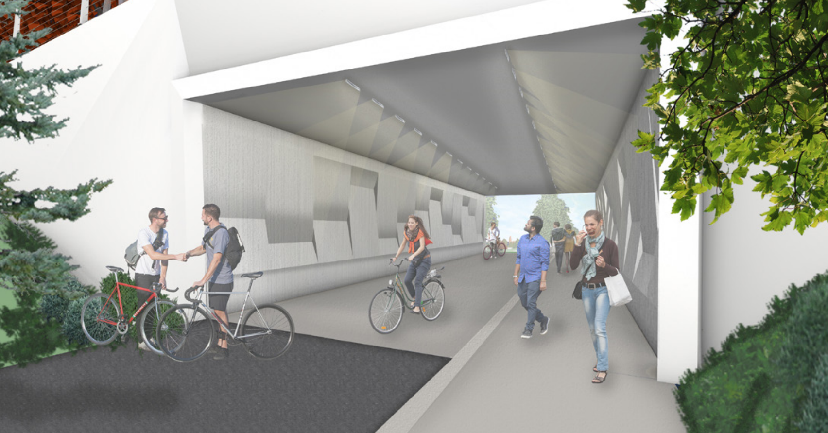
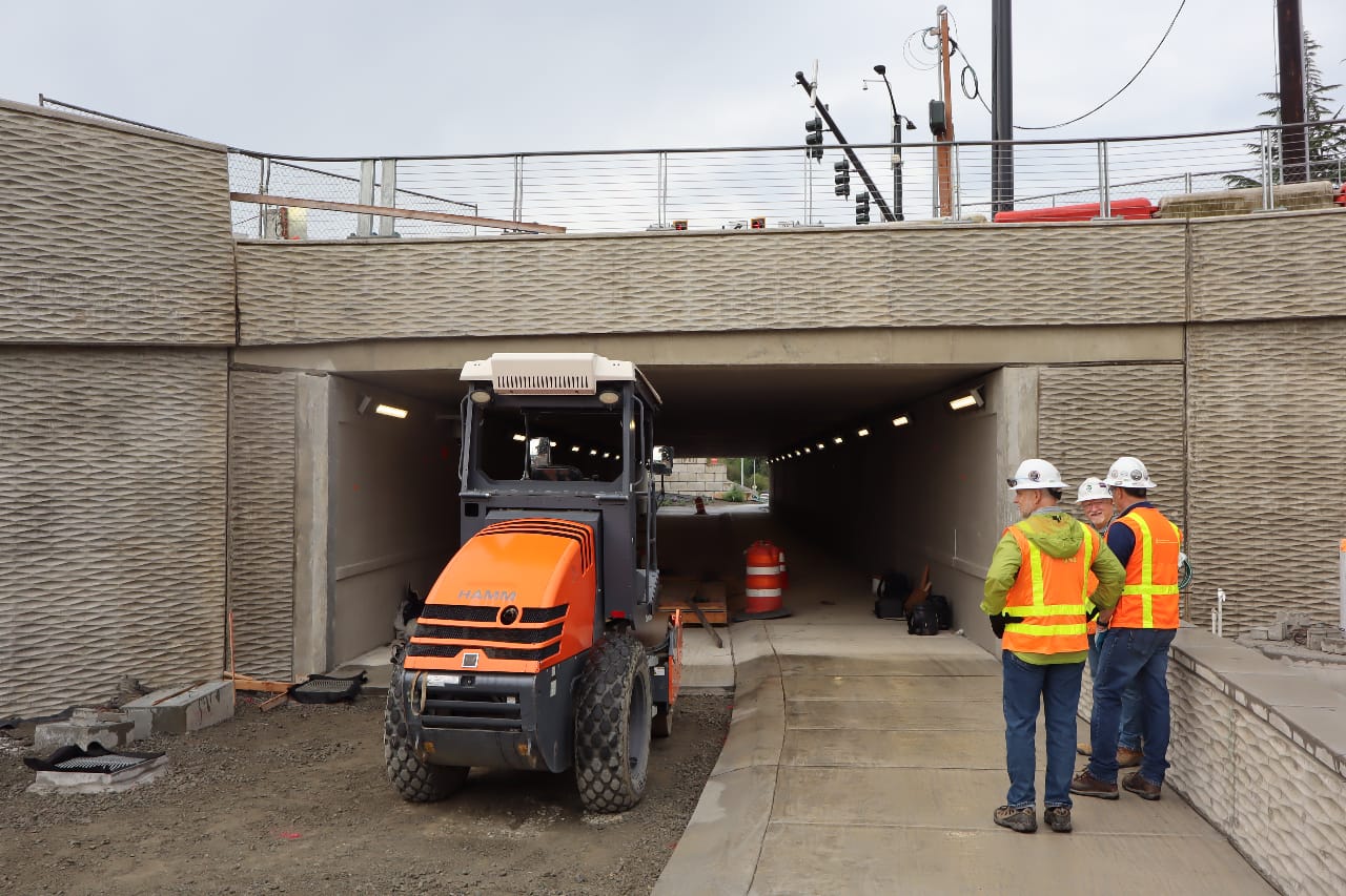
The Bike and Pedestrian Tunnel
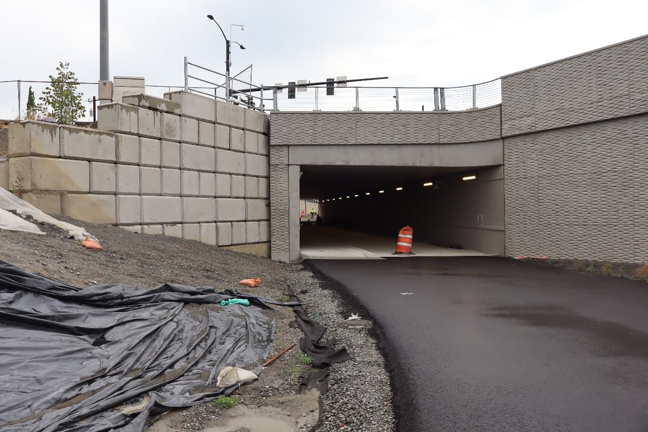
The new bridge over 520 won’t be the only way to avoid using Montlake Boulevard when all of this infrastructure opens. A new tunnel under the street allows anyone connecting from the 520 Trail to head directly to the Bill Dawson trail, which provides a connection to Montlake Playfield Park and the Seattle street grid, including a bike lane on Delmar Drive E. This tunnel, which will resemble the planned tunnel that was recently restored to the Roanoke Lid project after community advocacy, features separated walking and biking space to reduce conflicts.
Bill Dawson Trail users who are used to connecting to Montlake Boulevard from the west (near the NOAA Fisheries building) may be disappointed to find that they can no longer make that connection, but will instead have to go through the tunnel and circle back. But The Urbanist confirmed on the tour that this connection will ultimately be restored when 520 work is fully completed and the Portage Bay bridges are replaced, providing a full 520 Trail connection all the way between Medina and North Capitol Hill.
While many Montlake residents are likely just eager for construction to be done and for things around 520 to return to normal, the new infrastructure being added here is going to improve trips for thousands of people who pass through the area on a regular basis.