
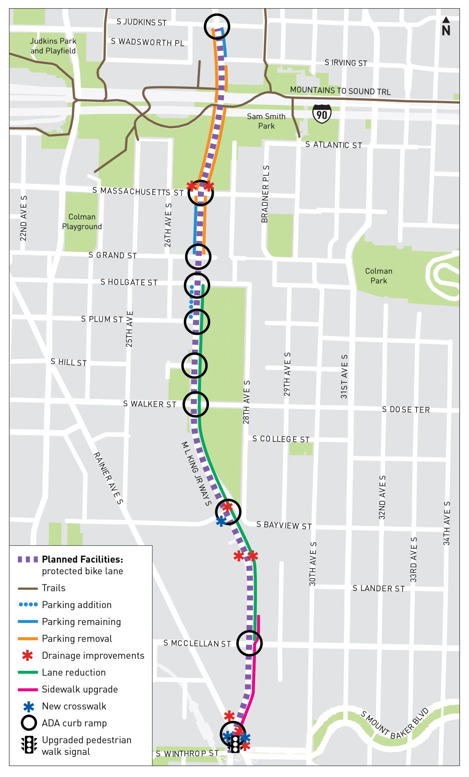
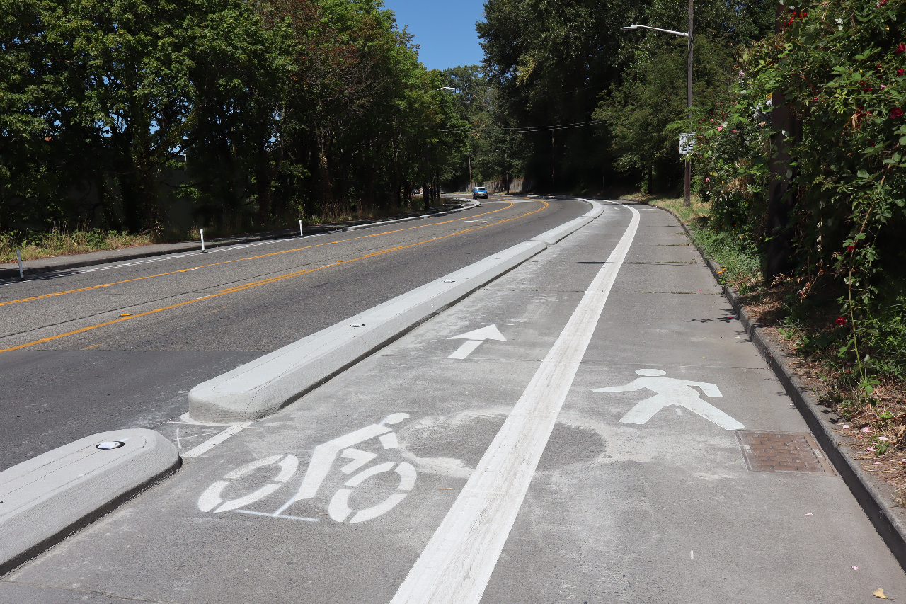
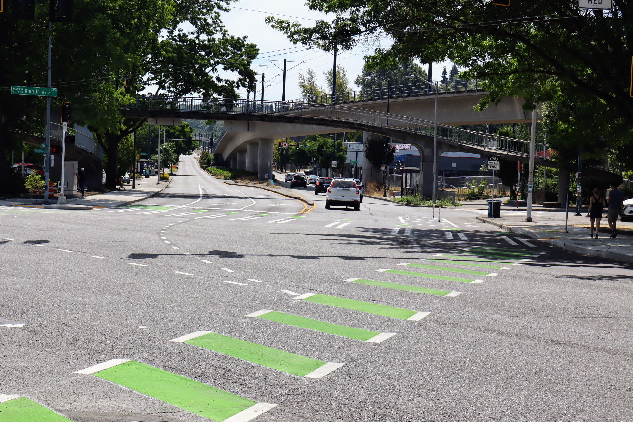
On July 30, the Seattle Department of Transportation (SDOT) announced that it had reached “substantial completion” on a brand new protected bike lane and traffic safety project connecting the I-90 Trail to the Mount Baker light rail station along MLK Jr Way S. An improvement for all modes of travel, the MLK Way project reduced the number of general purpose lanes on the street from two in each direction to one, added a bike lane on either side of the street, and filled a gap in the sidewalk network.
While construction on the project started late last year, adding this safe route on MLK had been in the works for long before that. It represents a first step toward fulfilling a critical need for separated bike facilities south of I-90 in the Seattle’s South End, where the pace of installing connected infrastructure has lagged well behind much of the rest of the city and the lion’s share of city traffic deaths have been concentrated. Other projects including a badly needed north-south bike route in Beacon Hill, a route between SoDo and Georgetown, and a trail between Georgetown and South Park are all coming on its heels, but MLK was the first to reach the finish line.
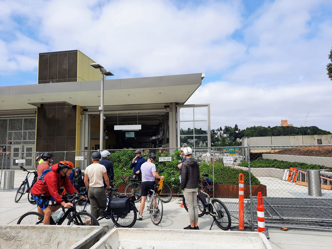
The bike lanes and expanded sidewalks will serve to improve access to East Link light rail as well, following the opening of Judkins Park Station, Seattle’s only new light rail stop on the 2 Line. That stop had been intended to open in 2023 before construction defects pushed back the scheduled opening of the I-90 section to late 2025 and prompted Sound Transit to open an Eastside-only light rail segment through Bellevue and Redmond in April 2024.
The grand opening of the improved MLK Way can be traced back to a 2019 decision by the Seattle City Council to get the city’s bike network connections to South Seattle back on track, following years of neglect. Though the 2015 Levy to Move Seattle promised voters 50 miles of protected bike facilities over a nine-year timespan, most of the initial projects that were funded after it was approved by voters were concentrated in Downtown, as the city focused on completing the Center City Bike Network. After SDOT released an initial plan for the rest of the levy in early 2019 that included no new connections south of I-90, the department held a series of open houses where the feedback was consistent: connect the South End.
By August, the Seattle City Council’s transportation committee, chaired at the time by Mike O’Brien, had introduced a resolution calling on Mayor Jenny Durkan to prioritize connecting the South End, with one-time funding identified from the sale of City property in South Lake Union, at the so-called Mercer Megablock.
“The current implementation plan, one of its major shortcomings is that at the end of the Move Seattle levy, if all that we built is what’s in the plan right now, there will not be a connection from Southeast Seattle to Downtown,” O’Brien said as the Council passed that resolution in September of 2019. “And if after this billion dollar levy is completed, we still are lacking a safe connection for our residents who live in Southeast Seattle to connect to Downtown, that will have been a failure.”
Overseeing that council meeting where the resolution unanimously passed was Bruce Harrell, at the time Council President.
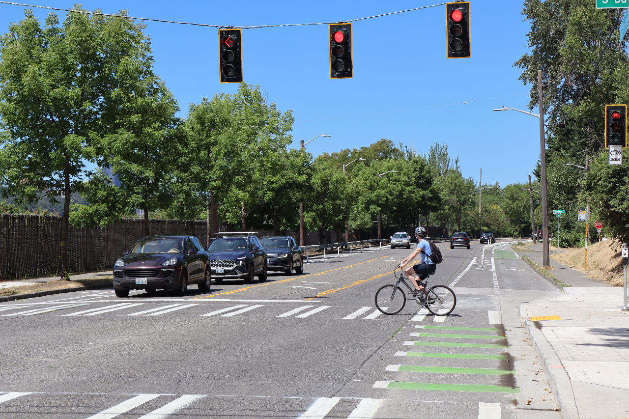
Anyone using the new bike lane on MLK to head south will find that the facility works well to get them to the front door of Mount Baker Station, connecting across Rainier Avenue but quickly terminating. The 2019 resolution actually called for the bike lane to extend all the way down MLK to Rainier Beach, at S Henderson Street. But the vision to continue the route has not carried through from the Durkan Administration to the Harrell Administration.
As voters soon turn in their ballots and decide whether to approve a new $1.55 billion successor levy to Move Seattle, the commitment to keep connecting the South End isn’t an included element. Instead, the levy focuses on upgrading existing bike infrastructure, only committing to an initial 10 miles of new protected infrastructure. That includes an extension of Beacon Hill’s north-south route, but not in the Rainier Valley, with the only new connections planned in the neighborhood an east-west route along S Henderson Street and a small connection for the Chief Sealth Trail around New Holly.
In 2020, SDOT asked consultant Toole Design to examine how protected bike lanes might be implemented on the entirety of MLK. That study informed the design of the connection that opened this summer, but the rest of the study — from Mount Baker to Rainier Beach — has been sitting on a shelf. Toole noted “notable advantages and drawbacks” to all options on the table, but at a high level the project was found to be very feasible.
“This work could be coordinated with preparations for the infill Graham St Link light rail station, which will also be an opportunity to make other major changes to MLK Way,” the study noted. The work on Graham Street has started to advance, but signs that SDOT is ready to make major changes to the channelization on MLK are few and far between.
While this project isn’t included in the proposed levy renewal’s workplan now, there’s no reason that SDOT could not change course after its passage to continue building a separated, protected route for Rainier Valley residents to connect to the rest of the city. But that will also take the type of vision that local leaders exhibited in 2019 when they got the first segment on track.
Ryan Packer has been writing for The Urbanist since 2015, and currently reports full-time as Contributing Editor. Their beats are transportation, land use, public space, traffic safety, and obscure community meetings. Packer has also reported for other regional outlets including Capitol Hill Seattle, BikePortland, Seattle Met, and PubliCola. They live in the Capitol Hill neighborhood of Seattle.