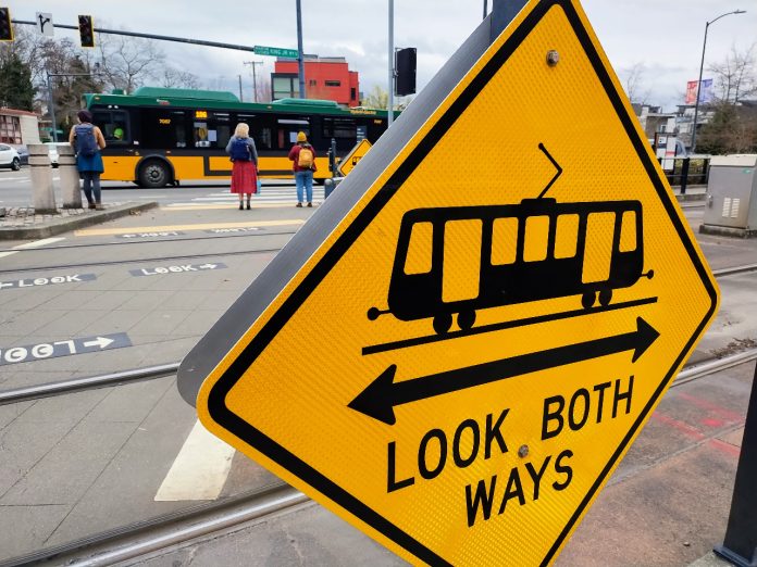
More than at any time in recent memory, political momentum seems to be building toward making improvements to MLK Jr Way S in the Rainier Valley, one of Seattle’s most dangerous streets and home to the longest stretch of at-grade light rail tracks mixed with traffic in the entire Sound Transit network. While nearly everyone agrees that problems on the corridor need attention, new ideas to significantly transform how the street operates are harder to find, with small tweaks proposed and some problems still being ignored entirely.
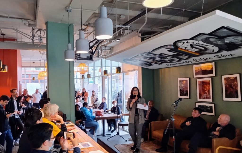
On Wednesday evening, King County Councilmember Girmay Zahilay and Seattle City Councilmember Tammy Morales co-hosted a town hall on the issue, packing the soon-to-open coffeeshop The Station, just across the street from Columbia City’s light rail station. Zahilay is newly appointed to the Sound Transit board of directors, and both elected officials are just starting their second term in office and seem determined to take another run at the issue of safety along MLK. The energy for change in the room was palpable.
The 4.5-mile stretch of at-grade track between Mount Baker and Rainier Beach features 27 crossings, 18 of which are open to vehicle traffic, the remainder only pedestrian and bike traffic. Crashes on the corridor are incredibly common, with the Seattle Department of Transportation (SDOT) recording over 170 crashes on MLK south of Rainier Avenue just in 2023 alone, an average rate close to one crash every other day. Most of those crashes didn’t involve light rail trains at all, but running the train at-grade through this section, a cost-saving measure adopted after the idea of a tunnel through the valley was discarded in the mid-1990s, has created problems before the line even opened in 2009.
Those problems were well-anticipated. “A decade ago, an environmental-impact statement predicted 29 car-train collisions per year, and three with pedestrians, based on experience in other cities,” the Seattle Times reported that year. “Transit officials said actual numbers would be less in Seattle, because of improved warning signals and road designs, as well as relatively careful drivers here.” The idea of crossing arms was rejected after nearby residents told Sound Transit in public meetings that they “didn’t want the area looking like a freight-train corridor.” By 2019, The Urbanist reported that train-involved collisions were happening every 40 days.
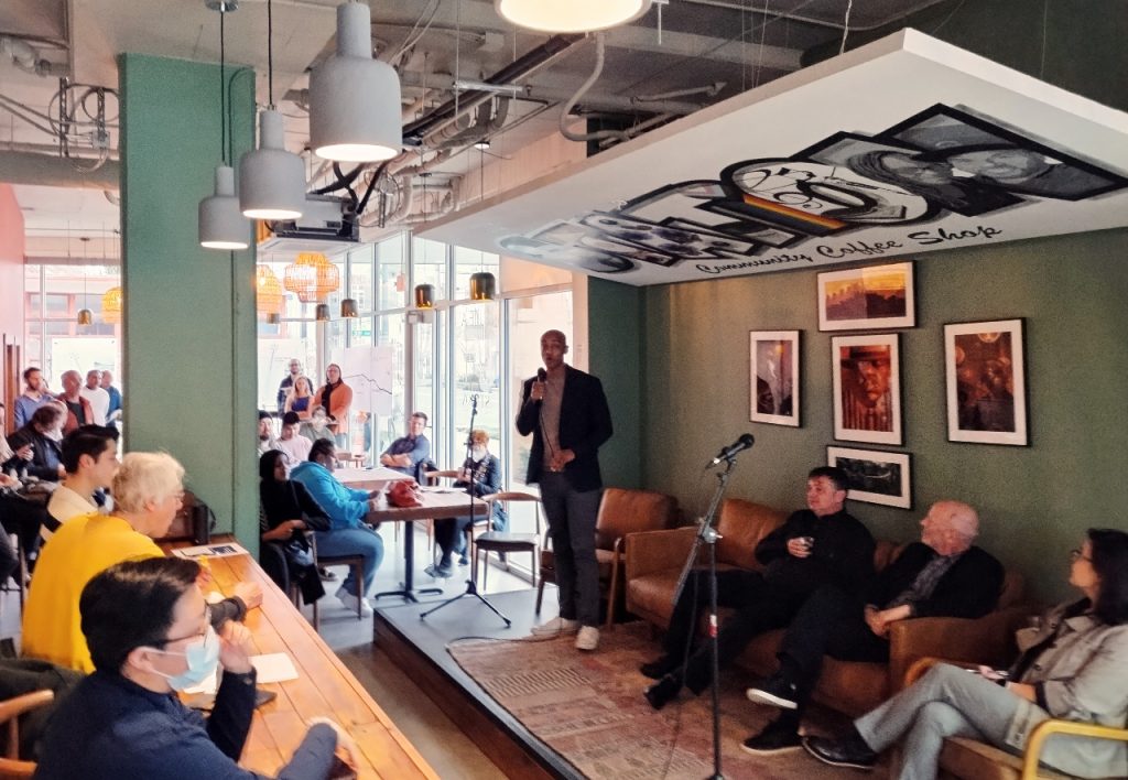
Last week’s town hall followed two “listening sessions” that Zahilay’s office hosted virtually earlier this year as the councilmember was getting onboarded to the Sound Transit Board. No other regional representatives to the body had started their term with public engagement on that level, and the events seemed to signal that Zahilay would be taking a different approach to decision-making on the body, which is made up of regional elected officials from King, Pierce, and Snohomish Counties. The issue of issues caused by running Link at-grade along MLK dominated both sessions.
“This is an issue that not just South Seattle should worry about; it’s an issue that our entire region should worry about, because our public transit systems are so interconnected,” Zahilay said in remarks kicking off last week’s event.
Councilmember Morales made reference to the fact that Sound Transit has all-but ruled out running at-grade light rail elsewhere in the system as it expands. “It’s important that we get it right as the system expands, it’s also important that we come back and make sure that investment is happening here,” she said. “This project isn’t finished, in my mind, until those safety improvements are made.”
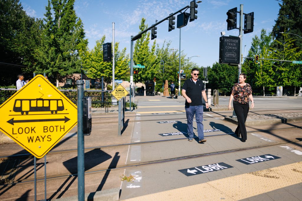
Some improvements have been made in recent years. In 2022, Sound Transit and SDOT signed a new agreement to work together on improvements along MLK, and in the following months, new warning signs and markings alerting pedestrians to the presence of trains went up around stations.
More recently, SDOT has been trying strategies that are less visible. Thanks to a $2 million SMART grant handed out from the US Department of Transportation, the department has been making tweaks to how the signals operate around the at-grade crossings, which are designed to prioritize north-south movement of the trains through the corridor. A pilot project, active right now between S Othello Street and S Henderson Street, seeks to test “a method of signal light synchronization that if successful will increase efficiency and safety for all travelers on the corridor while keeping light rail trains running on time.”
That work is a bit of a black box, but at last week’s town hall, SDOT’s Chief Safety Officer Venu Nemani touted the potential of the technology to prioritize pedestrian traffic at stations, potentially reducing the incidents of pedestrians getting impatient and crossing against traffic signals.
“I think we are entering a moment of alignment, that we need to take a Safe Systems approach to the at-grade light rail in the Rainier Valley,” SDOT Director Greg Spotts said. “We need to be thinking holistically about the experiences of our transit riders from their destination or point-of-origin to the station, crossing to the platform and getting on the train. And we need to think of the experience of all of the users across all modes and make that less chaotic and more safe and attractive for everybody.”
But almost completely absent from the conversation was any mention of issues created by the design of the overall MLK corridor: two lanes of fast-moving traffic on either side of the rail tracks widening even further to create space for turn lanes at intersections. A vestigial state highway turned arterial street, MLK is designed to prioritize the movement of vehicles. A speed study SDOT completed last year at MLK and S Alaska Street showed that 79.9% of northbound drivers are exceeding the 25 mph posted speed limit, with over 250 drivers per day on average exceeding 40 mph.
“I think in the discussion around the safety of the MLK corridor, we frequently forget that the large contributor to the unsafety is the speed of the car traffic, not the speed of the trains,” Rainier Valley resident Jason Rock told Zahilay at the first of his two listening sessions in January. “And I think that one of the things is that, as much as I think that Sound Transit and SDOT have tried to make improvements on this, the improvements are focused on the behavior of transit riders rather than on the behavior of drivers.”
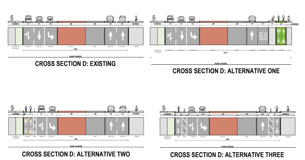
MLK isn’t very pleasant for people walking, and doesn’t really accommodate people on bikes at all — save for a 1.1-mile segment north of Mount Baker Station that will soon get protected bike lanes. In late 2021, Morales requested, via direction in the City’s budget, that SDOT develop a proposal to create a safe place to bike for people along the entire corridor. The result of that work, delivered to city leadership the following fall, was a set of preliminary designs that showed how space could be created on the corridor for bike facilities, work that would likely decrease overall vehicle speeds and create a more pleasant walking environment. But the Harrell administration has yet to signal interest in carrying any of those designs forward.
On the horizon are potential Sound Transit-focused changes like adding crossing gates, over two decades after that idea was rejected due to superficial concerns. But for the corridor to see a dramatic reduction in crashes and truly become a safe, people-focused street will likely take a much larger effort led by the City of Seattle. It’s not clear that such an effort has actually even begun yet.
Ryan Packer has been writing for The Urbanist since 2015, and currently reports full-time as Contributing Editor. Their beats are transportation, land use, public space, traffic safety, and obscure community meetings. Packer has also reported for other regional outlets including BikePortland, Seattle Met, and PubliCola. They live in the Capitol Hill neighborhood of Seattle.

