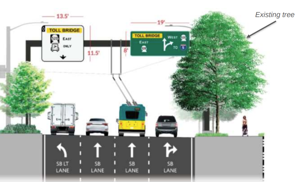
The state has $750,000 in tweaks planned that would scale back the size of road signage around the new Montlake Lid.
With many of the final pieces of the Washington State Department of Transportation’s (WSDOT) revamp of the area around State Route 520 in Seattle’s Montlake neighborhood being put into place over the past few months, project elements that have existed on paper for over a decade of planning and design have finally been turning into reality. And with that, nearby residents and visitors have been caught off guard by some aspects of the project that may not have jumped off the blueprints, but are nonetheless making a sizeable impression. That has prompted WSDOT to take a second look at what it had planned for the area.
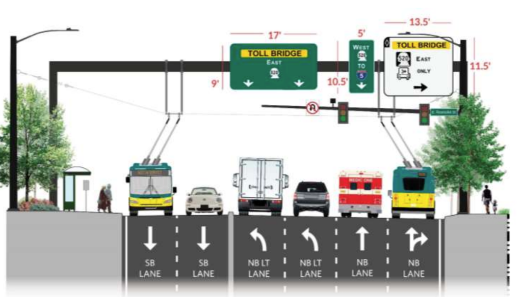
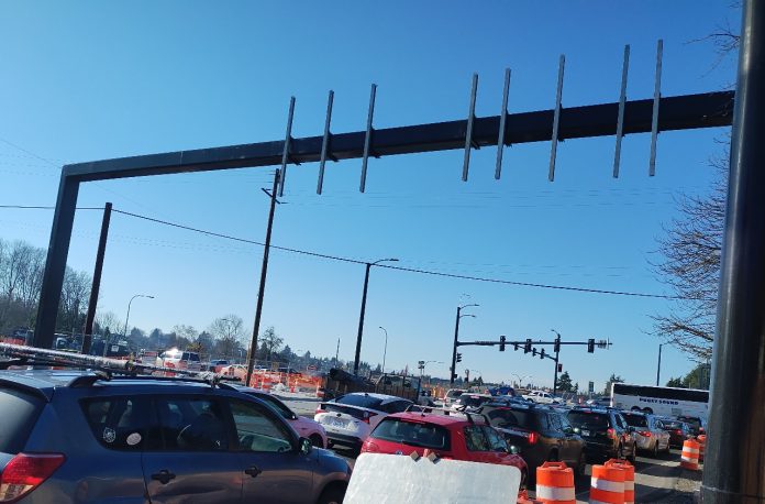
As WSDOT has started to rebuild Montlake Boulevard, the neighborhood’s main corridor, as a nine-lane street over SR 520 adjacent to the coming highway lid, nearby residents were taken aback not by the size of the roadway, but by the size of two massive steel sign bridges installed by crews in early fall of 2023, currently bare, which will ultimately hold signs directing drivers about which lanes to use when entering and existing the state highway or staying on the local road network.
“When I saw those sign bridges go up, I was appalled,” Montlake resident Rachel Ben-Shmuel said in January. “You know, not only were they enormous, but I felt like their potential for inviting people to act as if they were on the freeway before they were on the freeway created real safety concerns for pedestrians and cyclists.”
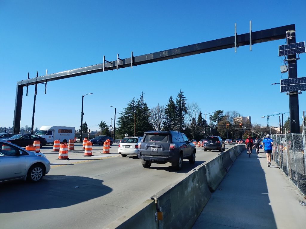
The reaction from the public was strong enough that WSDOT was prompted to hold a community meeting last October to hear concerns about the signs. At that meeting, it was noted that decisions about the sizing on the signs had been solidified around seven years prior, in 2016 and 2017. WSDOT also told attendees that the size of the signs was intended to match the complexity of the area.
“[T]he SR 520/Montlake Boulevard interchange is one of the most complex interchanges in the state, with nine travel lanes across the Montlake lid and multiple turning movements to communicate to drivers in a relatively short distance,” an agency-created summary from that meeting noted. “Montlake Boulevard’s heavy traffic volumes and numerous lanes led WSDOT to design multiple larger signs as well as larger supports to carry the weight of the signs.”
But in response to the strong feedback it had received, WSDOT created a work group that took a comprehensive look at how it might scale back the signage in the neighborhood, with the group of eight neighborhood residents meeting twice before the end of 2023. Plans to install a third sign bridge, between 520 and the Montlake bridge, were held off while WSDOT looked at what could be changed while still maintaining safety and legibility for users of the street. The result is a set of changes that the department estimates at around $750,000 in total cost that will dramatically decrease the amount of square footage that signs take up, in addition to the size of some of the hardware holding them.
While $750,000 is pocket change in the context of a $455 million contract for the overall Montlake project, that sum would be able to fund a not-insignificant number of new sidewalks, in a city with thousands of blocks lacking them.
The changes aren’t a done deal, yet. Funding still needs to be approved by the state legislature, either through a new allocation or via the use of existing funding. The legislature is currently in the middle of a disagreement over how to fund the remaining project within the overall SR 520 program, across Portage Bay and in North Capitol Hill, but that dispute is over an amount that’s one thousand times as large. After the legislative session ends on March 7, things should be more clear.
“I would say the likelihood that this is going to happen is very high,” Dave Becher, the SR 520 program’s director of construction, told attendees at a public meeting in late January where the recommendations were announced. One reason for that success appears to be the direct intervention of the 43rd legislative district’s delegation on the issue. Senator Jamie Pedersen, along with Representatives Nicole Macri and Frank Chopp, attended the first open house on the signage issue and appeared to treat it as a priority.
“I was excited to see the recommendations and to see that we’re headed toward a different result than it looked like we were going to be stuck with in the fall,” Senator Pedersen at that January meeting.
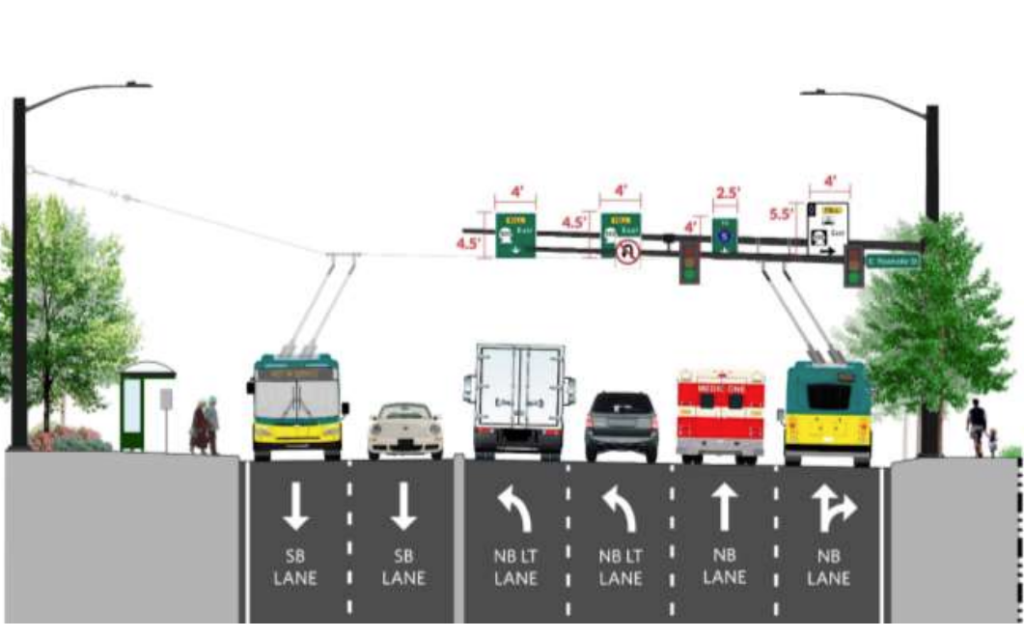
Under the plan, the sign bridge that was installed south of 520, near E Roanoke Street, will be removed by next year, and replaced with a smaller mast arm sign that extends over the roadway from one side only, with the size of the signs on the arms also scaled-down. It will also be moved slightly north, further away from homes. To make up for this change, an advance sign will be added further south, near E Louisa Street, to ensure drivers have enough time to make any lane change decisions.
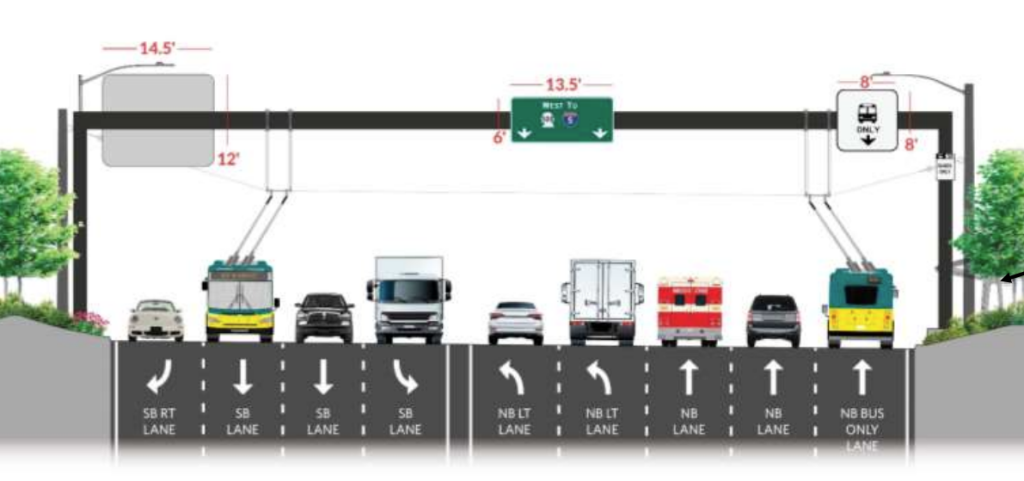
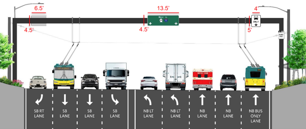
The large sign bridge immediately over the full nine-lane portion of Montlake Boulevard directly adjacent to the lid, however, will stay in place, due to the way that it’s integrated with the existing lid structure that’s already been created. But the signs will be reduced in size, bringing the largest down from 174 square feet to just under 30 square feet.
The third bridge, yet to be installed north of 520, will be replaced with a similar design to the first one to the south. That sign bridge was planned to span only the southbound lanes of Montlake Boulevard and will instead become a mast arm sign as well. Another supplementary sign will be added slightly further north.
David Goldberg, WSDOT’s community liaison and ombudsman for the 520 bridge replacement project, described the process as fairly novel for the state transportation department, an indication that it might provide a template for future refreshes on project designs that have been sitting on shelves for quite some time. He credited the neighbors who served on the work group for being willing to put in the time to find a common ground.
“My colleagues at WSDOT dug really deep, too, to stretch and put real options on the table,” Goldberg said. “And I think what we came up with is a hell of a lot better.”
Ryan Packer has been writing for The Urbanist since 2015, and currently reports full-time as Contributing Editor. Their beats are transportation, land use, public space, traffic safety, and obscure community meetings. Packer has also reported for other regional outlets including BikePortland, Seattle Met, and PubliCola. They live in the Capitol Hill neighborhood of Seattle.

