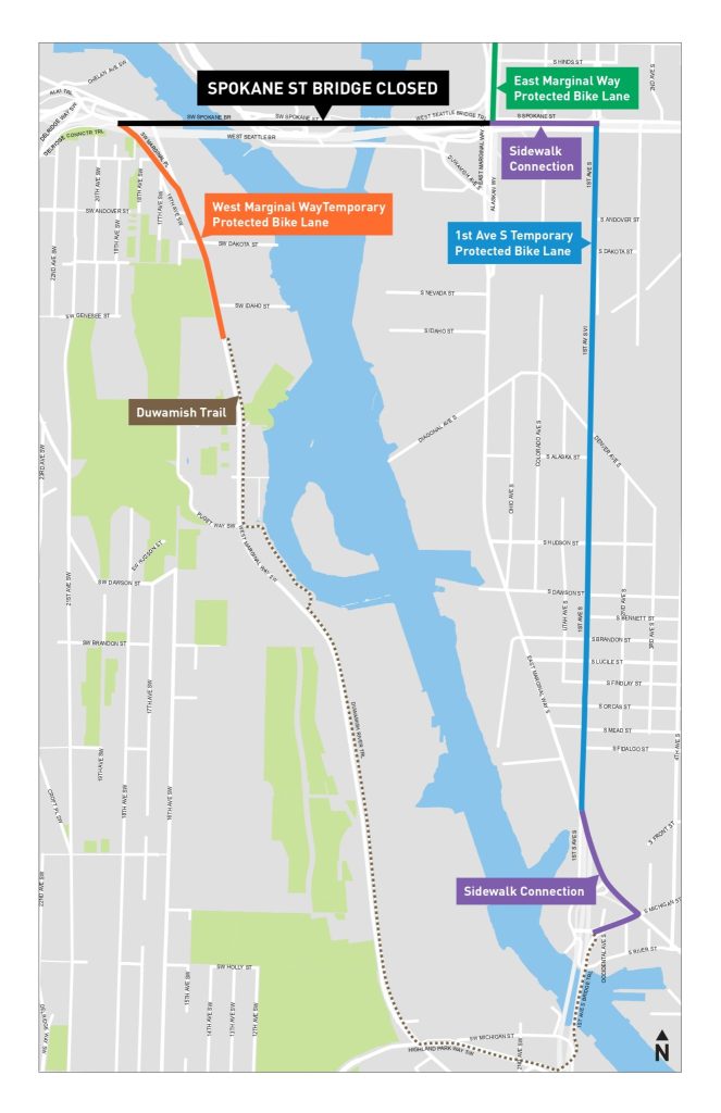
In response to the indefinite closure of the Spokane Street Swing Bridge, the Seattle Department of Transportation (SDOT) announced Tuesday that it would be constructing temporary protected bike lanes on the two primary streets that make up the recommended detour for people biking.
The bridge, which has been open to marine traffic only since an ice storm hit Seattle on December 23 and caused equipment to fail, is the only access between West Seattle and the rest of the city north of the 1st Avenue S bridge, operated by the state as a part of SR 99. That bridge, while it has a separated bike and pedestrian path, is cut off from the rest of the city’s bike network due to the hostile and deadly streets on the SoDo side of the crossing. Initially, SDOT said the closure would last at least two weeks, with no more information available on a timeline to reopen since then.
At a meeting of West Seattle Bike Connections on Tuesday night to discuss the plan, SDOT’s Meghan Shepard said that the Spokane Street bridge will need to close later in 2023 on several additional occasions as they continue to repair work on the bridge, but that the temporary bike lanes would not remain in place after the current closure. If the subsequent closures in 2023 last more than a few days they will add them back, she said, but not for closures of around a day in length, due to the time it takes to deploy the barricades.
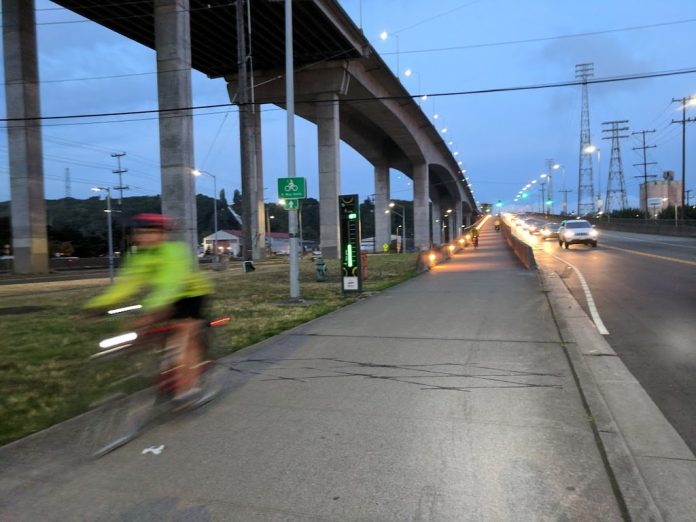
“This week, we are converting sections of W Marginal Way SW and 1st Ave S curb lanes to temporary protected bike lanes using cones, barrels, paint, and signs,” SDOT’s Ethan Bancroft announced via blog post. “The temporary bike lanes will remain until the Spokane St Swing Bridge reopens. We continue to procure traffic control devices and finalize the traffic control plan. We expect to complete the bike lane installation by the end of the day on Wednesday, Jan. 4.”
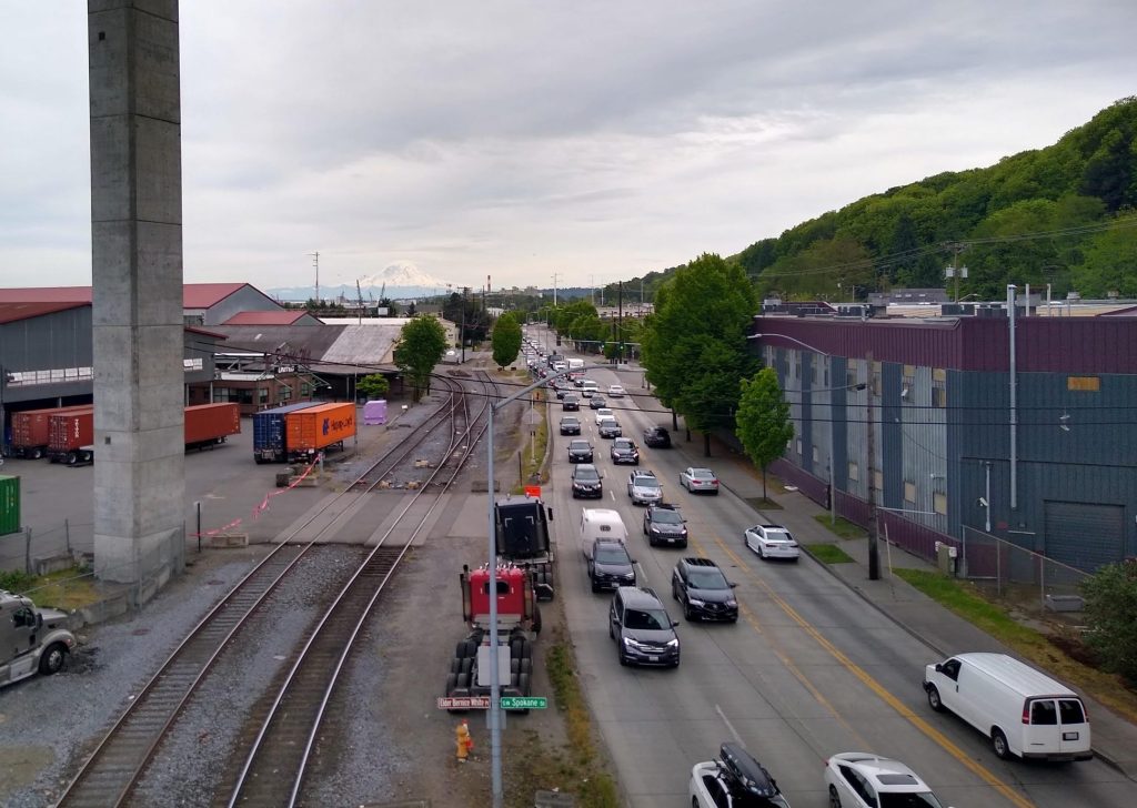
Last week, SDOT released its recommended bike detour route, which includes seven-lane 1st Avenue S as the primary street to use in SoDo. That street remains one of the few arterial streets fully controlled by the City of Seattle with a speed limit of 30 mph. The detour recommended people on bikes either use the sidewalk or the “sharrowed roadway.” Many experienced bike riders expressed concerns with the safety of riders using the recommended detour, particularly those who might not be aware that following signs for a detour meant a five mile route.

On the West Seattle side of the long detour, West Marginal Way features the separated Duwamish Trail for most of its length, making it a much more attractive detour than the SoDo side. But the Duwamish Trail abruptly ends about a quarter-mile from the reconnection to the West Seattle bridge trail, a gap that the city has been working to fill for several years now, despite pushback from freight interests who don’t want to lose any space on the “major truck street.”
Following the reopening of the West Seattle high bridge this past fall, SDOT announced that installation of a permanent bike lane filling the gap would be dependent on the result of an additional traffic study. Ideally, there would not need to be any gap between the temporary bike lane being in place and the installation of its permanent replacement.

As for 1st Avenue S, this temporary bike lane is a great demonstration project showing how a north-south protected bike lane through SoDo can function.
“While the temporary bike lanes are in place, 1st Ave S will have one general-purpose traffic lane in each direction, a center turn lane, and one bike lane in each direction,” Bancroft noted. “As possible, existing on-street parking will remain but be restricted near driveways to help people biking and driving more easily see each other.”
SoDo remains one of the most dangerous places in the city for road users of all types, with the quarter mile around the intersection of 4th Avenue S and Holgate (which includes a portion of this detour route) accounting for around 10% of all traffic fatalities in the city since 2020. Many people on bikes use the sidewalk, where their presence is not always expected: on May 11, 2022, Gan Hao Li, a downtown resident, was killed when a driver exiting a driveway struck him while he was riding on the sidewalk on 4th Avenue S.
Unfortunately, some portions of the official detour route will require riding on the sidewalk: on either end of 1st Avenue S, along S Spokane Street and East Marginal Way to get to the 1st Avenue S bridge. “You may wish to get off your bike and walk it through these areas with pedestrians,” SDOT noted.
Creating a temporary bike lane to accommodate people biking in an emergency closure like this is the right thing to do. The Seattle Bike Blog noted last week that cycling advocates in West Seattle and the Duwamish Valley have been trying to get this route improved for years, with urgency increasing after a nearly weeklong closure of the swing bridge in the summer of 2018. But prior to the current closure, improving access to the 1st Avenue S bridge on the SoDo side didn’t appear to be much of a priority, even as the state highway bridge remains one of the only ways for people walking and biking to cross the Duwamish river outside of a vehicle.
This also gets SDOT into the habit of being able to create temporary infrastructure like this around the city, a fact that the department itself noted Tuesday in its announcement. “Creating this temporary bike lane detour will help us to be more agile and able to consider similar detours during planned low bridge closures and at other locations,” Bancroft said.
We’ll be watching the detours as they take shape and noting any lessons that could be applied to future projects that not only respond to emergencies like the Spokane Street bridge closure but emergencies like the city’s traffic safety crisis and the global climate crisis.
Ryan Packer has been writing for The Urbanist since 2015, and currently reports full-time as Contributing Editor. Their beats are transportation, land use, public space, traffic safety, and obscure community meetings. Packer has also reported for other regional outlets including Capitol Hill Seattle, BikePortland, Seattle Met, and PubliCola. They live in the Capitol Hill neighborhood of Seattle.


