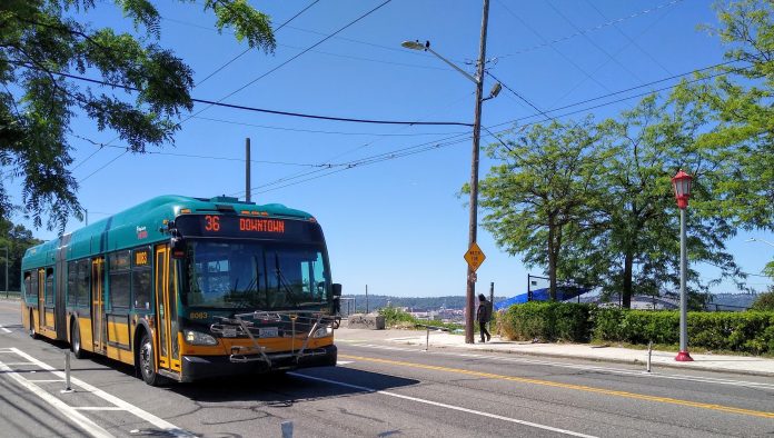
King County Metro’s Route 36, a workhorse route that connects riders throughout Beacon Hill and stretches from the Othello light rail station to Downtown Seattle, remained an incredibly well-used route throughout the entire pandemic. In 2019, the 9,200 daily riders that used the 36 every weekday made it the sixth most-used route in the system, and while in 2021 the numbers fell to 5,400 daily riders, it still remained the sixth most-used route in the system. To put that in context, one out of every 50 riders that use King County Metro take Route 36.
Yet, prior to the pandemic, Route 36 was becoming more and more unreliable. In fall of 2019, 40% of afternoon peak period trips on the route ran late, leading to fewer than three out of four total trips throughout the day being on-time. Multiplied by the number of trips Metro runs on the route every day, that adds up to a lot of hours sitting in traffic.
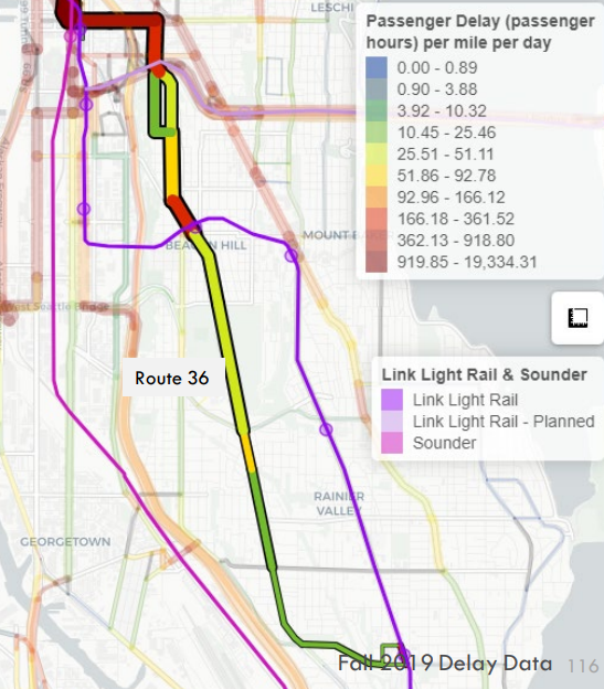
Metro is trying to get ahead of that congestion right now by moving forward with plans to alleviate some of the route’s biggest pinch points. It’s applying for a federal grant via the Puget Sound Regional Council, requesting a total of $3 million out of what it expects to be a total of $5.3 million for all of the planned improvements to the route.
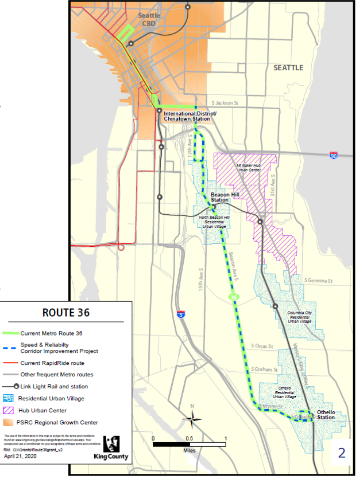
With that budget, Metro is planning to work with the Seattle Department of Transportation (SDOT) and a consultant to come up with improvements that yield a 10% improvement in bus travel times during peak hours, a five-minute gain across the entire route. The improvements that could get there are not set in stone right now, but Metro has produced a draft list of what they could look like. On the list are upgraded signals with Transit Signal Priority (TSP), curb extensions to allow buses to stop in-lane, and some bus queue jumps and transit-only lanes.

This work comes as SDOT is also designing a safe bike corridor along essentially the same route as the 36. This spring, SDOT announced that it had selected 15th Avenue S for its new bike facility in Beacon Hill’s north end, in part because Metro’s buses do not run along that street. But south of Beacon Avenue and 15th, the facility is planned to share at least some street space with Route 36, and we’ll be watching how the bike and bus projects end up complimenting each other — fortunately, there appears to be enough street space to prioritize both modes.
One of the key pinch points for Route 36 is the block immediately adjacent to Beacon Hill Station. Around 10 years ago, SDOT installed a raised center median in the middle of Beacon Avenue here to prevent drivers from passing buses stopped at the bus stops, creating dangerous conditions for people crossing at S Lander Street. More recently, SDOT has converted that uncontrolled pedestrian crossing to a signalized one where pedestrians wait to get a signal to cross.
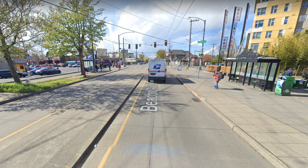
Metro has developed an early concept to remove or modify that center median, to create room for a southbound transit lane for the entire block in front of the light rail station. At McClellan Street, a queue jump would let buses head south first, ensuring they’re not stuck in traffic. Northbound buses could also get a queue jump at McClellan, although Metro doesn’t seem to think there is enough room on the block to also include a northbound transit-only lane.

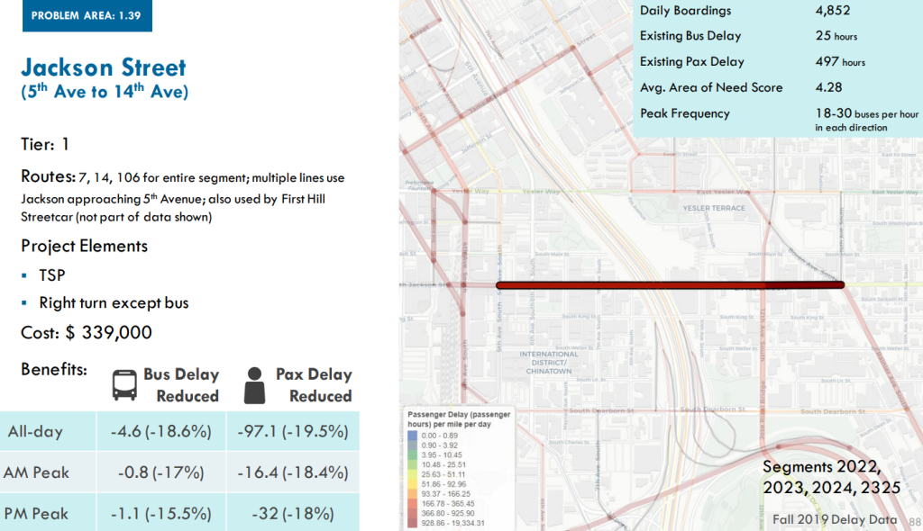
Not included in the scope of this Route 36 project is Jackson Street, the route’s connection to downtown. As we noted with SDOT’s announcement of northbound bus lanes on Rainier Avenue, Jackson Street is a significant source of bus delay. Metro’s 2022 Speed and Reliability report noted that Transit Signal Priority combined with a right-turn-only lane that could be used by buses could reduce delay along the stretch between 14th Avenue S and 5th Avenue S by close to 20%; Route 36 uses that stretch west of 12th Avenue S and would benefit from improvements along that segment as well. Metro’s report ranked improvements here as a priority 1, compared to only a priority 3 for the rest of the 36’s route.
Probably the most discouraging aspect of the Route 36 improvement project is its timeline: concepts would be developed in 2022 and 2023, designed in 2024 and 2025 and not installed until 2026. That’s a long time to realize beneficial wins that would come from speeding up the sixth most-used bus route in King County and illustrates an overall lack of urgency that’s also evident in SDOT’s current plan for Rainier Avenue bus lanes. Perhaps adding red paint and switching out traffic signals should have a timeline that’s significantly shorter than most highway projects, but, in any event, upgrades to Route 36 are badly overdue and when completed will create oversized benefits for transit riders.
Ryan Packer has been writing for The Urbanist since 2015, and currently reports full-time as Contributing Editor. Their beats are transportation, land use, public space, traffic safety, and obscure community meetings. Packer has also reported for other regional outlets including BikePortland, Seattle Met, and PubliCola. They live in the Capitol Hill neighborhood of Seattle.

