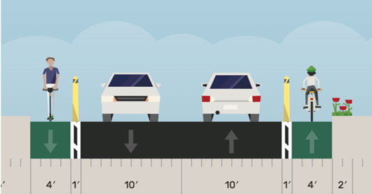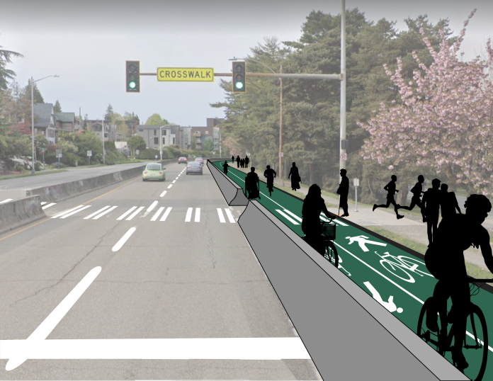
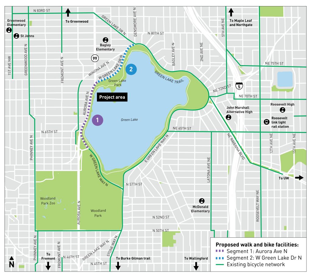
The Seattle Department of Transportation (SDOT) has shared a new survey on its plans to complete the protected bike network on the west side of Green Lake. The agency appears committed to adding a concrete barrier to create a two-bike facility on the lakeside shoulder of Aurora Avenue, but it has presented three options to create a protected facility on West Green Lake Drive N. Although design work is funded, construction is not, so the City will need to identify funds before it can build the project and close the Green Lake Loop. Still, SDOT is optimistic that construction could start by summer or fall of 2022, funding permitting.
The agency completed a two-way flexpost protected bike lane along East Green Lake Way this summer, but the facility ends at Densmore Avenue N where the lakeside road turns south and becomes West Green Lake Drive. This break in the loop forces people biking to use either a busy multi-use trail along the lake or a rutted narrow sidewalk that devolves into a goat path at times along Aurora Avenue — neither attractive options.
Alternative routes are limited as well. The steep slope up to Phinney Ridge offers a formidable obstacle for most riders and lacks an all ages and abilities route anyway. People could take the longer way around the lake for certain trips, but the detour may add a mile or more depending on the trip pair. The other major north-south bike routes through the area are Phinney/Greenwood Avenue N, Latona Avenue NE to the south, and 5th Avenue NE to the north, none of which are protected routes, and Roosevelt Way NE, which is protected but only in the southbound direction. Stone Way N offers a connection to the south, but protection is lacking south of N 50th Street, making the street a harrowing and dangerous experience for many people biking.
The City’s plan to add a protected bike lane between N 50th and 45th Streets as part of this project was abandoned under the leadership of Councilmember Alex Pedersen, who chairs the transportation committee. SDOT cited funding shortfalls due to the Covid pandemic as a reason for backing away from the plan.
Finishing the Green Way Loop and adding protection on the paint-only lanes on Stone Way would go a long way toward filling in the bike network in this part of the city. Green Lake is a destination park, and it’s unfortunate that it can be hard to reach without a car.
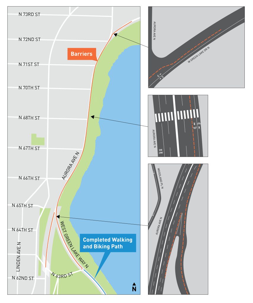
Adding a concrete barrier along Aurora Avenue would also have the added benefit of improving the pedestrian environment, in addition to making it far safer as a bike route. SDOT’s survey hints that the completion of the outer loop may lead Seattle Parks to tighten restrictions on biking and scooting on the inner loop, as it did as part of its “Keep It Moving” campaign during the summer.
The three West Green Lake Drive N options
While the solution on Aurora is fairly straightforward, SDOT is considering three options along West Green Lake Drive, which each have their own merits.
Option 1: Remove street parking and maintain vehicle travel lanes in both directions, and add a two-way walking and biking path on the lake side of the street. Removing park is the simplest solution, but it could rile homeowners in the area. That said, with Winona Avenue N offering more of a thoroughfare for motorists, both travel lanes aren’t really needed here.
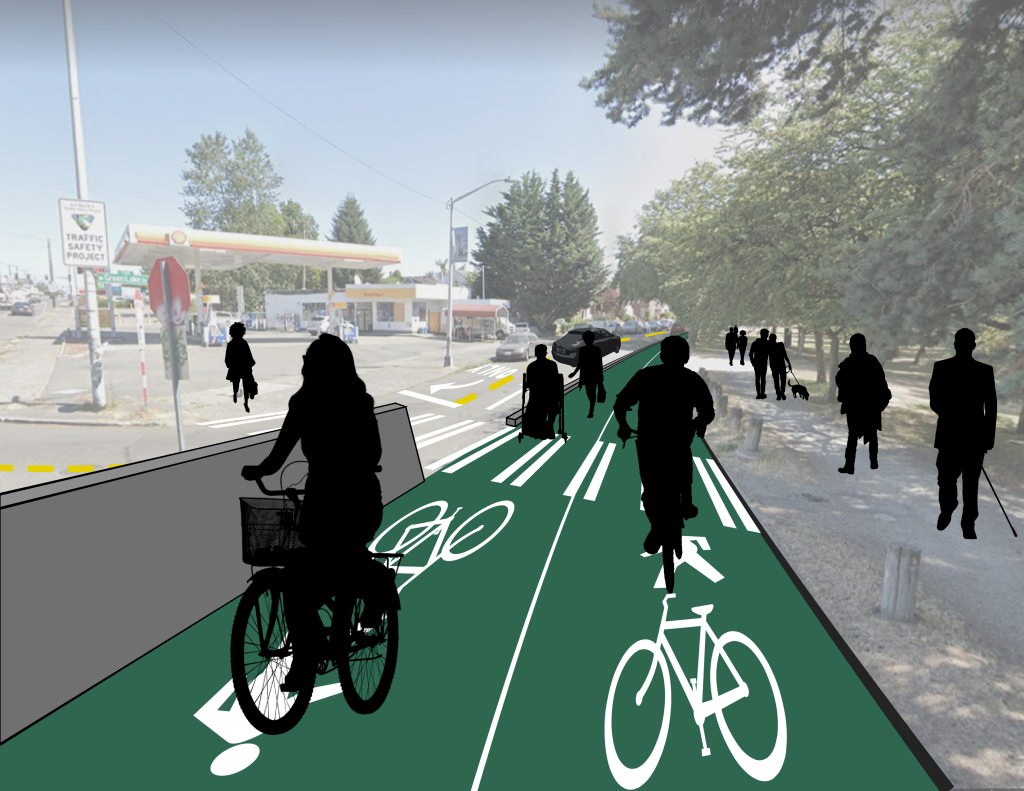
Option 2: Maintain street parking, but remove either a northbound or southbound vehicle travel lane, and add a two-way walking and biking path on the lake side of the street. A one-lane street would be even easier to cross, which is a plus for pedestrians, and it would decrease turning conflicts at the intersection with Aurora Avenue. However, some motorists may end up riding over the curb into the bike lane in order to parallel park their large American automobiles on this narrow street.
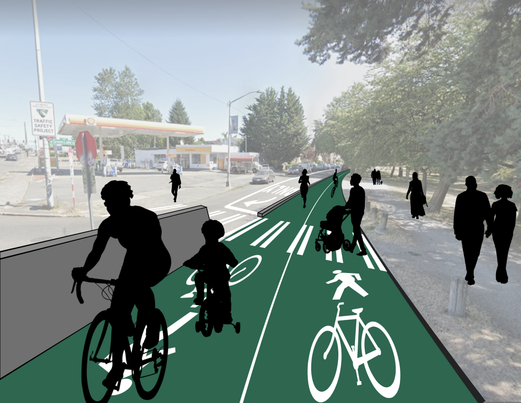
Option 3: Remove parking, two-way travel, and bike lanes on each side. As this option doesn’t have a rendering yet, it appears the least fleshed out and likely to be selected. Since the facility for the rest of the loop is two-way along the lakeside, adding a two-way facility could force an unnecessary crossing for some users, but the narrower street should be fairly calm. The flexposts would also be a downgrade from a curb-protected lane.
Looking ahead and public comment
SDOT has an open house presentation for people seeking more information on the project. Those looking to comment on designs can email GreenLakeOuterLoop@seattle.gov or take SDOT’s survey here. The survey is open until December 6th. Additionally, Green Lake and Wallingford Safe Streets has a petition urging the City to complete the loop, which pushes for the concrete barrier design. SDOT will be presenting the project to the Phinney Ridge Community Council on December 7th. If all goes smoothly, the project could be open by the end of 2022.
Doug Trumm is publisher of The Urbanist. An Urbanist writer since 2015, he dreams of pedestrian streets, bus lanes, and a mass-timber building spree to end our housing crisis. He graduated from the Evans School of Public Policy and Governance at the University of Washington in 2019. He lives in Seattle's Fremont neighborhood and loves to explore the city by foot and by bike.

