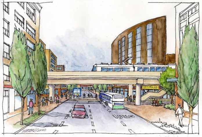
On August 3rd, Snohomish County returned with a Summer Survey to continue their light rail planning process. When we last covered Snohomish County’s Light Rail Communities project in fall 2020, the County was seeking input on housing in urban unincorporated Snohomish County and presented data on housing density acceptability and affordability. This time around, the County is seeking feedback on form-based code, or land use development regulations that craft a specific urban form. Design preferences for parking, tree canopy, streets, and sidewalks are among the many elements of urban landscapes that the survey hopes to elucidate.
The County likely has a decade and a half before light rail arrives in the subarea, but it’s still important they receive positive urbanist feedback very early in the process to steer land use and design code changes. Especially if you’re a resident of Snohomish County, be sure to participate in the survey and spread the word. Additional feedback can be sent to the project email at LightRailComm@snoco.org. The email can also be reached for interpreter and translation services for non-English speakers, accommodations for persons with disabilities, and a print version of the survey.
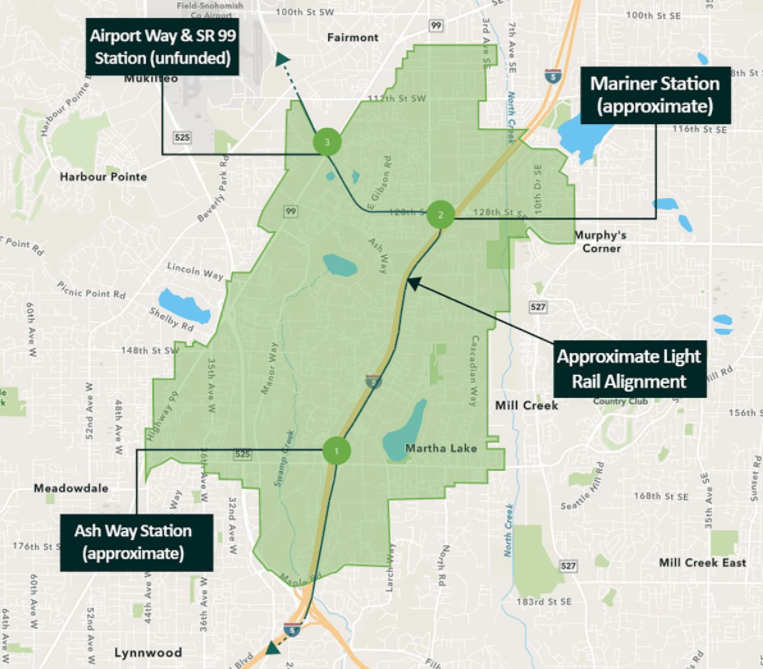
The survey serves the County’s Light Rail Communities project that is currently developing a subarea plan for urban unincorporated Snohomish County in an area spanning between the cities of Everett, Mukilteo, Lynnwood, and Mill Creek. Three light rail stations will eventually serve the subarea, with their expected openings estimated in the mid-2030s to the early-2040s. A recent realignment decision by Sound Transit has provided more clarity to potential opening dates, but future financial aid or shortfall may destabilize the timeline. The subarea plan prepares unincorporated urban Snohomish County for these new stations with a focus on land use, transportation, housing, parks and recreation, public services and utility needs, and economic development. The 2021 Summer Survey is focused on gathering public input on land use and transportation. Let’s dive into the details on the public feedback they are requesting.
Land Use
The land use section of the survey is brief. It swiftly asks participants for their favorability on options for parking placement, tree canopy rules, and development incentives.
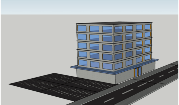
The page on parking explains parking infrastructure plans for multifamily housing, commercial building, and mixed-use buildings. Despite the County’s acknowledgement that it is standard for urban core subareas to be denser neighborhoods focused on active transportation, they believe they have to include parking to fit the needs of Snohomish County. As a result, options on the survey are limited to rating favorability of different types of parking infrastructure configurations, including surface parking behind a building, surface parking to the side of a building, and parking within a building. All seem unfavorable for a “light rail community,” but while it’ll be more expensive, parking within a structure — above or below street elevation — may be the best use of space in a neighborhood that is supposed to be dense.
Next, the survey asks participants to rank the importance of expanding tree canopy requirements to public/institutional use areas, commercial use areas, industrial use areas, and surface parking lots. Currently, only residential projects have tree canopy requirements for new development.
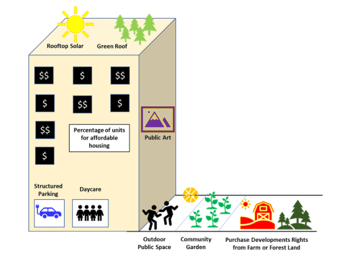
In the final land use section of the survey participants are asked to rank the importance of many different urban design elements and public amenities. This feedback will be used to help create developer incentives that may allow projects to have greater square footage or additional floors past concurrent land use regulations. Items up for ranking include rooftop solar panels, green roofs, a target percentage for units of affordable housing, whether or not to locate more than 75% of required parking within a structure, public art, daycare, indoor or outdoor public space, community gardens, and the purchase of development rights from farm or forest land. Participants are also welcome to recommend other amenities — bike facilities are among those missing.
Transportation
The transportation section kicks off with a sampling of currently used modes of transportation and a hypothetical that presents what transportation modes could increase with better facilities and services. With that data collected, the survey dives into participants’ thoughts on typical road cross section features in current commercial/mixed-use areas in the subarea. Afterwards, participants are asked to rank several series of features and to indicate supportiveness of and comfort with potential features in street compositions.
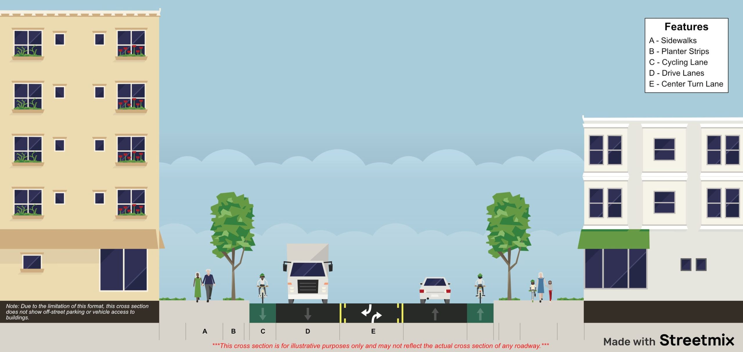
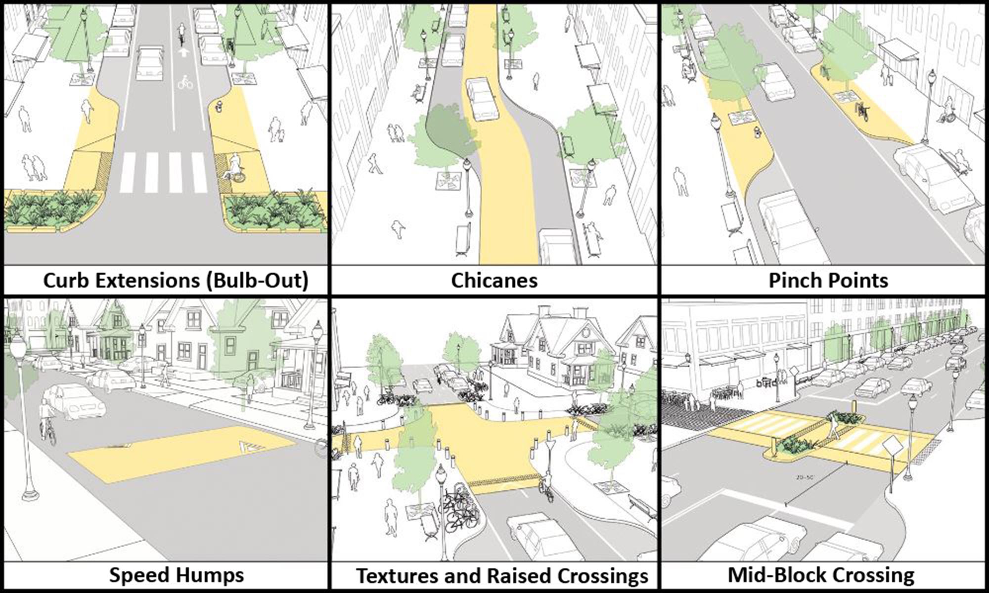
Today, the typical street cross section in unincorporated urban Snohomish County has small setbacks of buildings from sidewalks, center turn lanes, unprotected bike lanes, street trees, no more than two drive lanes, planter strips, limited pedestrian amenities, and no on-street parking. Participants are first asked if they like or dislike the listed features, then they are asked to rank them with a few additions like bus lanes and drop-off zones. After the ranking, the survey presents limited versions of each feature to test levels of support for street updates such as excluding transit lanes/biking facilities or narrowing drive lanes. The next page then quickly defines and asks participants to indicate supportiveness for curb extensions, textured and raised crossings, mid-block crossings, pinch points, speed humps, and chicanes.
Sidewalks and bike facilities are covered next. Opinions on minimum sidewalk width are asked for with a multiple-choice question that offers width selections ranging from two to four people to pass each other. Level of comfort with bike lanes next to sidewalks is also asked, with perspectives of both pedestrians and bicyclists requested. Cyclists are also asked for feedback on their level of comfort with using lower speed drive lanes, different degrees of protected and unprotected bike lanes, and shared lanes with buses.
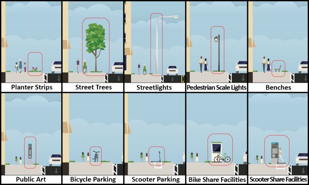
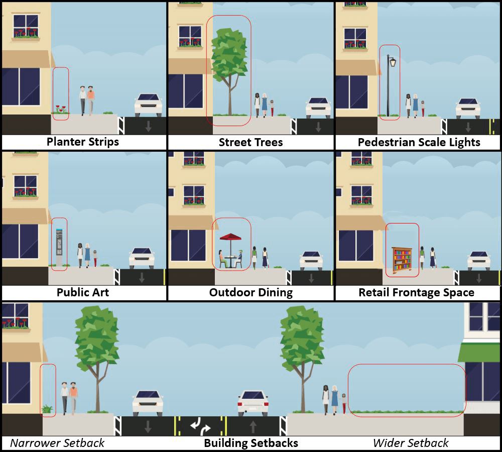
Lastly in transportation, spaces between roadway, sidewalks, and buildings are up with participants asked to rate their support levels for permit parking zones in residential zones and commercial zones, metered parking in commercial/mixed areas, and the removal of some on-street parking for loading zones. The last two form-based questions discuss the “landscape area” — in between the sidewalk and street — and the building frontage area. The survey has participants rank a variety of features by importance, perhaps inspired by pandemic-adaptation importance of outdoor dining and retail frontage space.
What’s next
With all of the substantive questioning done, standard demographic questions and an additional feedback request conclude the survey. Unlike the bigger picture housing workshop, this feedback request by Snohomish County dives into the minutia of how streetscapes of the subarea should eventually look. Like last time, it’s good to see that the County is presenting possibilities that could appropriately support and take advantage of a light rail system with strong non-car infrastructure, pro-density land use regulations, and incentives that create compelling spaces. It’s also a great opportunity for community members and advocates to help shape the form of urban Snohomish County with code considerations.
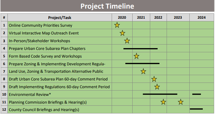
The Summer Survey is scheduled to be open through September 12th. Opportunity to give feedback on the wider project is still in its relatively early stages, as the project will continue through 2024. Though the pandemic may have pushed the original schedule, we may see the draft plan sometime next year. If you want to follow early planning for Snohomish County’s light rail communities, be sure to follow the project website and sign up for updates.
Shaun Kuo is a junior editor at The Urbanist and a recent graduate from the UW Tacoma Master of Arts in Community Planning. He is a urban planner at the Puget Sound Regional Council and a Seattle native that has lived in Wallingford, Northgate, and Lake Forest Park. He enjoys exploring the city by bus and foot.


