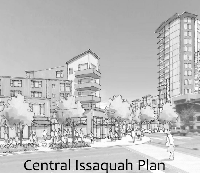
As the part of the Central Issaquah development moratorium, the city is refreshing the district visions established in the original Central Issaquah Plan (CIP) adopted in 2012. For the update, start on page 45 of the current draft. The update seeks to further focus dense mixed-use development in Central Issaquah and bridge the obstacle of I-90.
Several significant things have happened since 2012 that may profoundly change how Central Issaquah will develop over the next 20 to 40 years, including:
- Coscto signed a development agreement (DA) to add 1.5 million square feet to their existing corporate campus, effectively tripling their current footprint and committing the Fortune 100 company as an anchor for Central Issaquah for decades to come. The DA also includes funding for the SE 62nd St extension, which should go a long way towards improving connectivity north of I-90.
- Sound Transit 3 was approved, guaranteeing that Issaquah will, eventually, have a light rail station somewhere within Central Issaquah. Additionally, King County Metro Transit has updated their long-long plan, Metro Connects.
- Lake Sammamish State Park was annexed by the city. The city is working with the Washington State Department of Natural Resources to potentially fund a new DA and Environmental Impact Statement to completely rebuild and reorient the state park to better interact with the city to the south and east.
- Compact school zoning, allowing for denser, more efficient schools within the Issaquah School District.
Additionally, the actual development that has occurred within Central Issaquah hasn’t met the original vision, resulting in the current moratorium. The city is concerned about the loss of retail in the city’s tax base as residential apartment blocks replace strip malls. The CIP emphasizes mixed-use development throughout, but most recent development has been single use. Members of the community have also been unsatisfied by the quality of design of recent developments, such as Atlas and the Gateway Apartments.
The city held community meetings at the beginning of the year and just worked through the visions with the Planning Policy Commission (PPC), including a fun tour of the existing neighborhoods. As a result of these discussions, there are several major changes to the district visions, including:
- New structure to the vision pages
- District consolidations
- Removal of “Service” and “Old Route 10” from the CIP
- Increased emphasis on the Green Necklace
New Structure
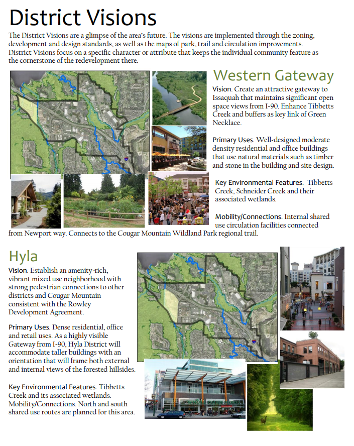
The current district visions are very forward looking but sparse on current context and actionable steps. The new format tries to formalize the presentation and put some more “meat” on the visions with specific Developer Obligations, City Implementation Actions, and Measures of Success. For example, the Western Gateway calls out near-term work such as the rebuild of Newport Way currently in planning and longer term projects such as a future pedestrian crossing of I-90 west of SR-900.
District Consolidation
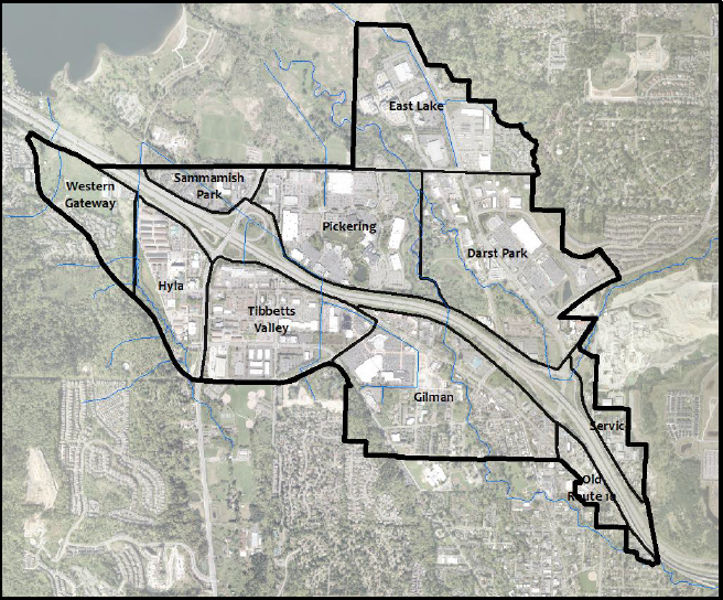
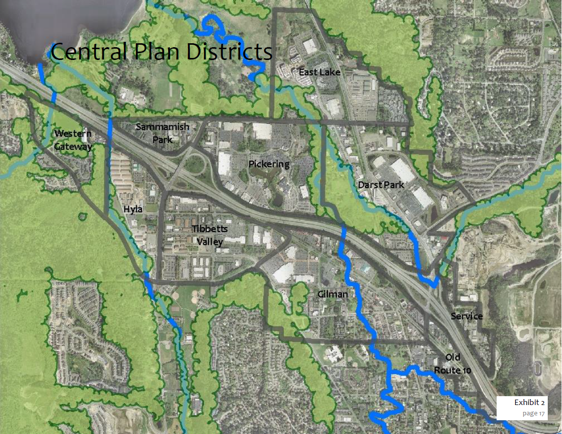
There are 10 districts in the original CIP, with Interstate 90 acting as a key dividing line between districts. The official Puget Sound Regional Council growth area consists of four districts, Sammamish Park, Hyla, Tibbets Valley, and Pickering. During this update, the commission felt that using I-90 as the dividing line between districts meant accepting the scar that is I-90. Instead, the new district vision consolidates the four districts into a single district, Issaquah Valley. By explicitly spanning the freeway, the new district articulates a vision in which I-90 is overcome as an urban boundary and is permeable for cars, pedestrians, and transit.
In a similar vein, East Lake and Darst Park districts were consolidated into a single district, Eastlake, to articulate a vision that the East Lake Sammamish Parkway should be a boulevard that stitches together a single, coherent neighborhood.
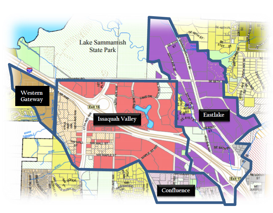
Issaquah Valley was initially referred to by staff as simply the “Regional Growth Center,” a wonky and decidedly boring name. As a wonky and boring person myself, I was the only person the Planning Commission that did not insist we improve our branding with a better name. Issaquah Valley is the current working name, but time will tell if that is what is used by the community.
There was concern about making the districts too large and abstract for place-making, so the new documents will do a bit of wordsmithing and talk about “districts” and “neighborhoods.” The districts are the overarching vision—Issaquah Valley as the urban, vertical mixed use core; Eastlake as a horizontally mixed-used area less dense than the GRC, and Western Gateway and Confluence functioning as transitions to the single-use, mostly residential neighborhoods outside of the CIP. In turn, the old, smaller districts exists as “neighborhoods” and are used for place-making and way-finding. In the new district visions, each neighborhood is given a distinct “current” and “future” vision, and each district has a single set of obligations, actions, and measures of success.
There was also some good discussion around the specific boundaries between Issaquah Valley, Eastlake, and Confluence. Initially the district boundaries followed the existing zoning (red & purple shading), but the commission felt it was important that the longer term vision dictates the current zoning, not the other way around. For example, Gilman village was moved to Confluence, where its treasured but low-density theme was more appropriate.
Service and Old Route 10 Districts
The Service neighborhood was intended to function as Issaquah’s “start-up” incubator space and home for various light-industry and other service-oriented uses. It will still continue to play this role within Issaquah, but it was felt the design enhancements to the urban environment that are at the core of the CIP weren’t particularly relevant.
Old Route 10 contains may local jewels, such as The Grange, Boehm’s, and the Triple XXX root beer drive-in. As such, the commission felt this district didn’t fit the CIP with it’s emphasis on urban redevelopment, and instead the district is a better fit for the Olde Town subarea where the emphasis is on preserving the existing vitality while allowing infill development. The zoning will not change as a result of the removal from the CIP, but the CIP standards (i.e., a more urban design form) will not apply. In 2018, the city will consider adding this area to the existing Olde Town subarea, although seamlessly integrating the two neighborhoods into a cohesive subarea may be challenging.
Green Necklace
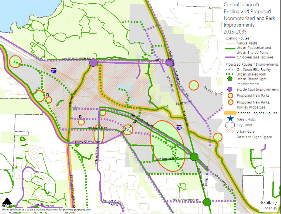
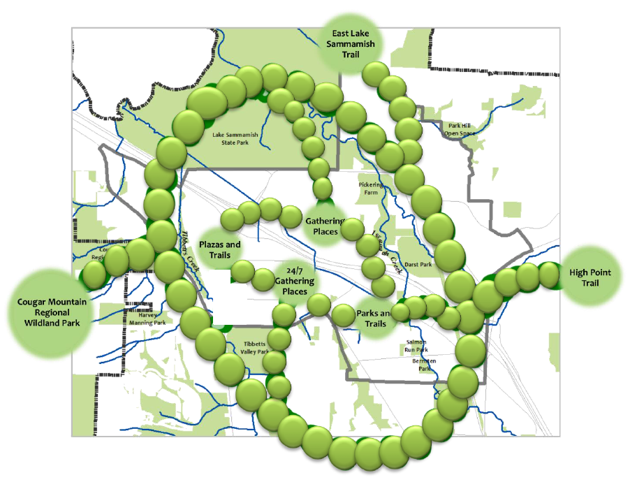
The Green Necklace has long been a key part of the entire city’s vision, not simply the CIP. However, the PPC felt the Green Necklace was not sufficiently emphasized in the CIP and wanted it to exist as a standalone vision coequal with the district visions. City staff was receptive to this suggestion and played around with some creative visualizations to best express the vision of the Green Necklace. The difficulty is not getting bogged down with all the implementation details, which are already included in the CIP (see above), while clearly illustrating how the green necklace connects the city to the natural features that define it, particularly Lake Sammamish and the Issaquah Alps.
Next Steps
The updated draft of the visions will be presented to the Land & Shore committee on Thursday, December 7th at 6.30pm at Council Chambers in City Hall South.
AJ McGauley
AJ McGauley was a temporary transplant in the Seattle area, living in East King with his lovely wife for five years before returning to the great Midwest. Having lived in nine very different cities in the six years prior to moving to Washington, he discovered the wonky side of urbanism after reading The Urbanist and is interested in why cities grow (or don’t grow) in different ways. He worked for Sound Transit and can still be found riding transit for fun.

