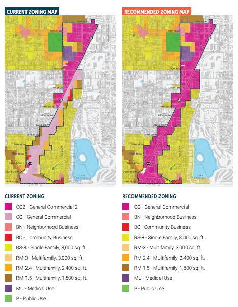
Edmonds has adopted a major subarea plan for an urban district on SR-99. The Edmonds City Council passed four related ordinances on August 15th to realize the subarea plan, which included rezoning most adjacent properties on SR-99 for urban mixed-use, adding new development regulations, adopting a planned action ordinance, and expanding and revising the city’s multi-family tax exemption (MFTE) program. The subarea rezone involved consolidating two variations of General Commercial zoning to one type of General Commercial and expanding it to many properties with other commercial and multi-family zoning within the area.
Zoning, Development Capacity, and Regulations
The new General Commercial zone will generally allow for 75-foot tall buildings, which is an increase of 15 feet, or one story, over previous development regulations. A portion of the district near the intersection of SR-99 and 220th St SW will allow unlimited height, but will be subject to a special review process. Other properties that were rezoned will see an even bigger jump in development capacity and may see an expansion of allowed uses.

The rezone represents a significant increase in capacity for jobs, housing units, and residents in the area. By 2035, the subarea plan assumes there will be an additional 3,325 housing units, 3,013 jobs, and more than 1.6 million square feet of commercial space with the rezone (Alternative 2). Keeping zoning the same would have netted less new housing, jobs, and commercial space:

The new development regulations seek to enhance urban design and create a walkable urban district. The following table summarizes most of the regulations that will guide the design of new development in the area:
| Development Standard | New Standard |
|---|---|
| Parking | - Non-residential uses: two stalls per 1,000 square feet of leasable area - Residential uses: Average minimum of 0.75 stalls per unit - First 3,000 square feet commercial uses within mixed-use buildings when they have a shared parking plan |
| Parking Location | - Parking areas shall not exceed a maximum of 40% of street frontage |
| Building Frontage | - A minimum of 50% of primary street frontage must have buildings within 10 feet of front property line - 50% of side and rear frontages must have buildings, walkways, or hedges at least four feet in height within 10 feet of property lines |
| Building Transparency | - At least 50% of primary building frontage facade within two and 10 feet of height, which is measured from the adjacent sidewalk, the bottom of which may not exceed four feet above the adjacent sidewalk, must be transparent with windows and doors - All other frontages require 30% transparency - Windows shall not be mirrored or have glass tinted darker than 40% |
| Pedestrian Activity Zone | - Designate a 10-foot Pedestrian Activity Zone in place of existing Type IV landscape buffer along all primary street frontages with ground floor retail; future design standards may consider special circumstances, such as auto dealer locations |
| Ground Floor Setback | - For frontages on SRR-99, require a front setback of 10 feet to accommodate a Pedestrian Activity Zone - For frontages not on SR-99, reduce frontage setbacks to five feet and encourage enhanced pedestrian realm (e.g., larger sidewalks and usable landscaping) - Keep current 15-foot setback and 10- foot landscaping requirements for lot lines adjacent to single-family residential zones |
| Upper-Level Stepback | - Adjacent to single-family residential zones, provide 10-foot upper-level stepback for portions of a building above 25 feet; provide 20-foot upper-level stepback for portions of a building above 55 feet - Across the street from single-family residential zones, provide eight-foot upper-level stepback for portions of a building above 25 feet; provide 16-foot upper-level stepback for portions of a building above 55 feet |
Planned Action Ordinance
The rezone is also paired with a planned action ordinance, which will generally eliminate the piecemeal project-level environmental review under SEPA (State Environmental Policy Act). A planned action ordinance is an optional means under state law to waive SEPA review for individual development projects in a specific area if a full subarea environmental study is conducted and mitigation measures adopted.
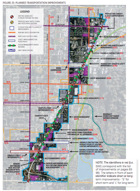
Environmental regulations to protect shoreline environments, wetlands, and streams were already codified in city law. However, the city adopted other specific development regulations, such as aesthetic and urban design requirements, near- and long-term transportation investments, and public service investments, that will act as mitigation measures. These mitigation measures were studied as part of the Environmental Impact Statement (EIS), which was published earlier this month.

The planned action ordinance will cover all projects in the SR-99 subarea for as long as the total development remains below the maximum number of jobs, housing units, and other features studied in the EIS. For applicants, skipping the SEPA review process saves applicants money and time. It can also reduce some risks to appeal since SEPA determinations are appealable decisions.
Revised and Expanded MFTE Program
As a secondary action, Edmonds chose to revise and expand the city’s multi-family tax exemption (MFTE) program. The MFTE program will now apply to the SR-99 subarea in addition to Westgate Mixed Use district allowing developers to voluntary set aside on-site affordable housing units. Under state law, the property tax exemption may be available for up to 12 years so long as the designated units remain as affordable. At least 20% of the units must be designated as affordable and rented or sold to households at affordable rates.
Edmonds chose to modify their program by requiring 10% of units to be rented or sold to “low-income households” at or below 80% of area median income and 10% of the units to be rented or sold to “medium-income households” at or below 150% of the area medium income but more than 80% of the area median income. Previously, the MFTE program had not defined the rates for household types. The program could incentivize affordable housing development and overall interesting in the SR-99 area for development
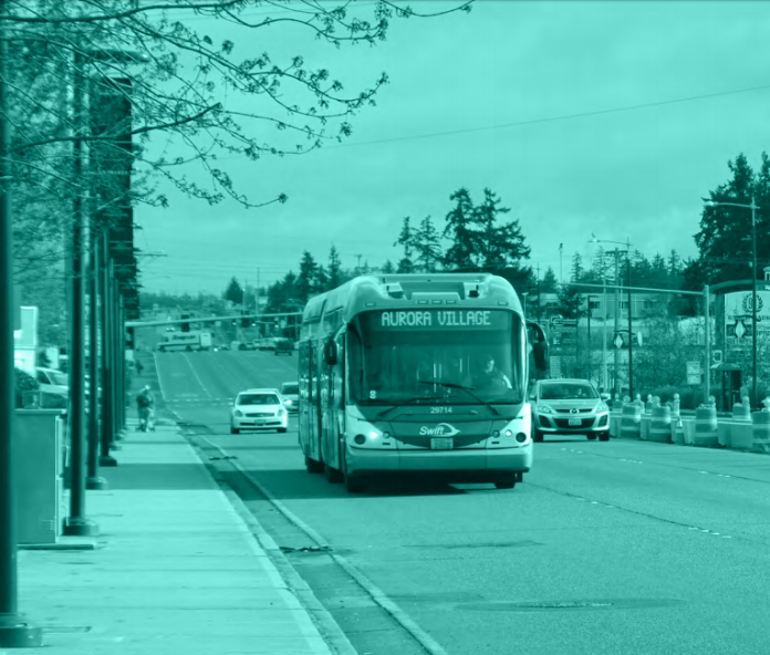
The featured image of SR-99 is from the Subarea Plan and courtesy of the City of Edmonds.
Stephen is a professional urban planner in Puget Sound with a passion for sustainable, livable, and diverse cities. He is especially interested in how policies, regulations, and programs can promote positive outcomes for communities. With stints in great cities like Bellingham and Cork, Stephen currently lives in Seattle. He primarily covers land use and transportation issues and has been with The Urbanist since 2014.


