In late September, the King County Council’s Transportation, Economy and Environment (TrEE) Committee met to discuss amendments to the King County Executive’s Recommended Plan for the County’s 2016 Comprehensive Plan Update. As a major update, the County often looks toward significant changes to the Comprehensive Plan. Numerous land use proposals were considered through the update cycle, but the County largely focused on non-Urban Growth Area expansion changes to Future Land Use Map (FLUM). The following summarizes the the FLUM and zoning changes that the TrEE approved through the committee process, plus two extra proposals that were not reviewed by the TrEE. A public hearing will be held on the land use proposals on November 28th at 1.30pm and a final vote by the full Council could occur as early as December 5th.
Rural FLUM and Zoning Changes
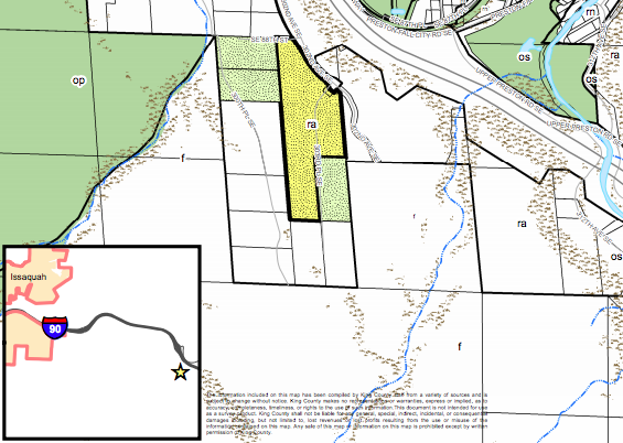
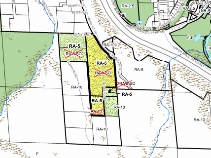
In the Preston area, the Executive recommended only zoning changes to five properties. The SDO zoning designation was proposed for removal since the condition only governs critical areas, which are now simply subject to the County’s critical areas ordinance. The split zoning (RA-5/RA-10) on the largest parcel was proposed to be consolidated to the higher density zoning of Rural Area-5 (RA-5). The TrEE affirmed this proposal with no changes.
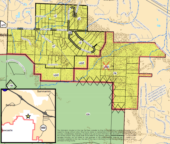
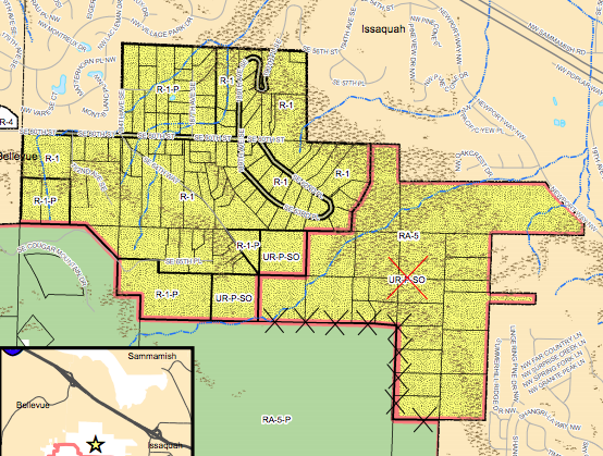
The East Cougar Mountain Potential Annexation Area proposal is the result of a request by the City of Issaquah to remove 24 parcels of land from their Potential Annexation Area and the Urban Growth Area. The Executive recommended the proposal to the Council, which would not only remove those parcels of land from the Potential Annexation Area and Urban Growth Area, but also redesignate and rezone them. The 24 parcels are proposed to go from Urban Planned Development (upd) to Rural Area (ra) on the FLUM and Urban Reserve (UR-P-SO) to Rural Area-5 (RA-5) on the zoning map. The TrEE Committee affirmed the Executive’s proposal.
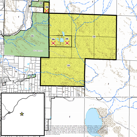
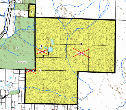
The Executive’s Taylor Mount Forest proposal sought to create consistency between a series of adjacent forestland parcels by modifying FLUM designations and zoning. One parcel was proposed to change from Forest (f) to Open Space (os) on the FLUM. Another two parcels were proposed to change from Rural Area (ra) to Open Space (os) on the FLUM. Eleven parcels of land were proposed to change from Rural Area-10 (RA-10) to Forest (F) on the zoning map. The TrEE Committee affirmed the Executive’s proposal.
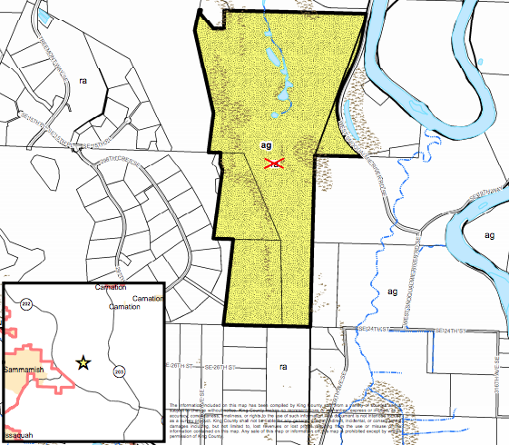
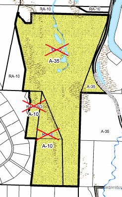
The Executive’s Tall Chiefs Golf Course proposal sought to add rural land to the local agricultural production district by modifying FLUM designations and zoning. Three parcels of land were proposed to change from Rural Area (ra) to Agriculture (ag) on the FLUM. Proposed zoning changes included one parcel going to Agricultural-35 (A-35) and two going to Agricultural-10 (A-10). The TrEE Committee affirmed the Executive’s proposal.
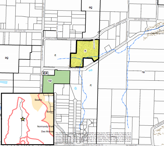
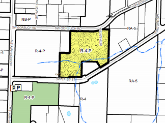
The TrEE Committee introduced a site-specific zoning change as part of the Vashon area plan. The FLUM would not be modified as part of the proposal. The zoning change boils down to conditions specific to the site, which currently limits development to only mobile homes, manufactured homes, and accessory structures. The zoning change would replace the site conditions to limit development to only “housing designated for low-income.”
Urban FLUM and Zoning Changes
The TrEE Committee supported three sets of adjustments to urban FLUM and zoning changes in the Fairwood, Federal Way, and Maple Valley. The Maple Valley changes present a unique case where the urban growth area would effectively expand through the County’s Four-to-One process.
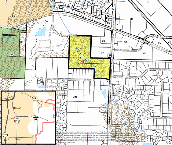
Earlier this year, the Executive’s Recommended Plan had studied four large parcels of land in the Fairwood area and proposed FLUM and zoning changes on the northernmost parcel. The proposal sought to increase residential densities from Urban Residential Medium (um) to Urban Residential High (uh) with a corresponding rezone from R-6 to R-18. The southern three parcels were proposed to remain unchanged. The TrEE Committee, however, adopted an amendment to the proposal to redesignate and rezone the southern three parcels of land as well, subject to specific conditions, which is the properties are shown with a special “P” suffix.
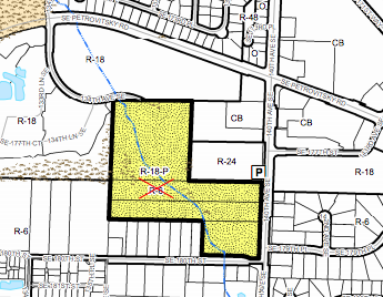
As a result of the proposed zoning, any future multi-family residential project would have to include some combination of senior residential single-family, senior citizen assisted housing, day care facilities, and nursing and personal care facilities, or if none of those, the project would have to provide at least 20% of the new residential units as affordable for moderate-income households.
The Executive recommended that a corner lot outside of Federal Way be redesignated and rezoned. The site is currently designated Urban Residential Medium (um) with R-4 zoning. The Executive’s recommendation sought to change the site to a Neighborhood Business (nb) designation and rezone to Neighborhood Business (NB). The TrEE Committee affirmed the recommendation without change.
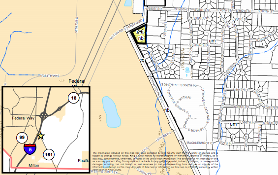
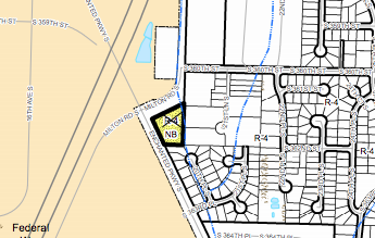
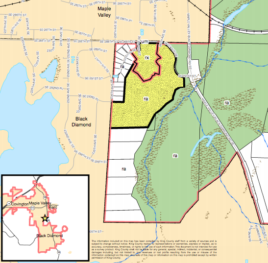
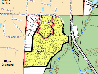
The Rainier Ridge zoning proposal in the Maple Valley area is a unique case where the Urban Growth Area would be expanded if approved, but there is a little backstory to it. The property owners of Rainier Ridge, a subdivision, entered into an agreement with the County under the Four-to-One program, which allows property to be added into the Urban Growth Area and developed at urban intensities. Certain requirements must be met by proposals, but in this case, the developer had to agree to setting aside 56 acres of land for conservation purposes in 2014. The remainder of the property (14 acres) was permitted to be added to the Urban Growth Area contingent upon the the City of Maple Valley commencing annexation proceedings and entering into an interlocal agreement. The TrEE Committee amended this condition to require annexation to be completed on or by December 31, 2017 and removing the interlocal agreement requirement. If this condition is not met by the deadline, the Rainier Ridge property would revert to its Rural Area (ra) FLUM designation and Rural Area-5 (RA-5-P) zoning.
Minor Technical Corrections to UGA Boundaries
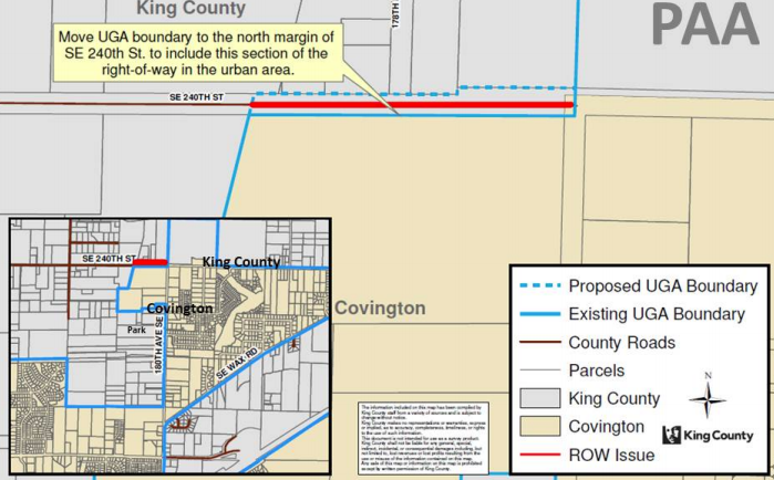
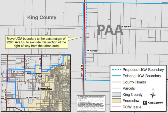
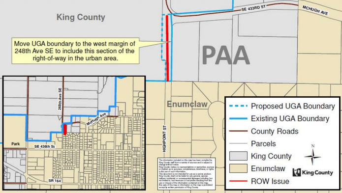
The TrEE Committee supported three technical corrections to Urban Growth Area boundaries that largely have to do with where the lines are drawn for right-of-way. The technical corrections focus on changes to boundaries near Covington and two near Enumclaw.
In the case of Covington, the line is proposed to move the Urban Growth Area boundary from the middle of SE 240th St to the north side of the right-of-way for a few hundred feet at most northwestern edge of the city.
The urban growth area boundary changes near Enumclaw would resolve right-of-way issues on 228th Ave SE. One segment of 228th Ave SE in the unincorporated Urban Growth Area would be removed, setting the urban growth boundary along the eastern edge of the right-of-way. The other segment of right-of-way would be added to the Urban Growth Area.
Other Four-To-One Proposals
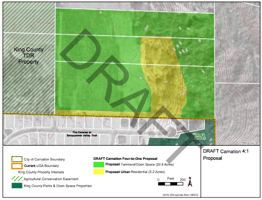
A proposal near Carnation seeks to add 5.2 acres of land to the Urban Growth Area and set aside 20.8 acres into open space under the Four-to-One program. The proposed urban portion of the property would go from Rural Area (ra) to Rural City Urban Growth Area (rx) on the FLUM and Rural Area-10 (RA-10) to Urban Reserve (UR-P) on the zoning map. The open space would be dedicate for permanent public use.
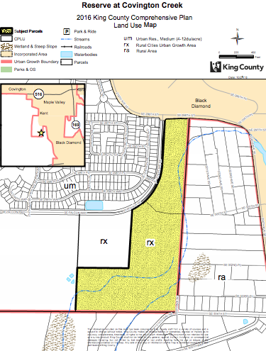
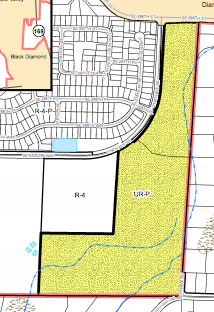
A Four-to-One proposal at the edge of the Urban Growth Area near Black Diamond is proposed to be amended through zoning-based conditions. The proposed changes would:
- Require that the development proposal meet or exceed engineering standards set by the City of Black Diamond;
- Require that Level of Service not be degraded by the development;
- Eliminate the requirement for a pre-annexation agreement be created to guide development; and
- Eliminate a requirement for Transfer of Development Rights to be purchased (equivalent to 160.30 acres), but would add a condition that only 50% of the urban-designated site could be development with a maximum of 80 lots.
The King County Council will hear these issues as part of the whole 2016 Update Comprehensive Plan package on November 28th.
Attachment B to S1 Land Use Zoning Amendments 09-01-16 by The Urbanist on Scribd
Stephen is a professional urban planner in Puget Sound with a passion for sustainable, livable, and diverse cities. He is especially interested in how policies, regulations, and programs can promote positive outcomes for communities. With stints in great cities like Bellingham and Cork, Stephen currently lives in Seattle. He primarily covers land use and transportation issues and has been with The Urbanist since 2014.


