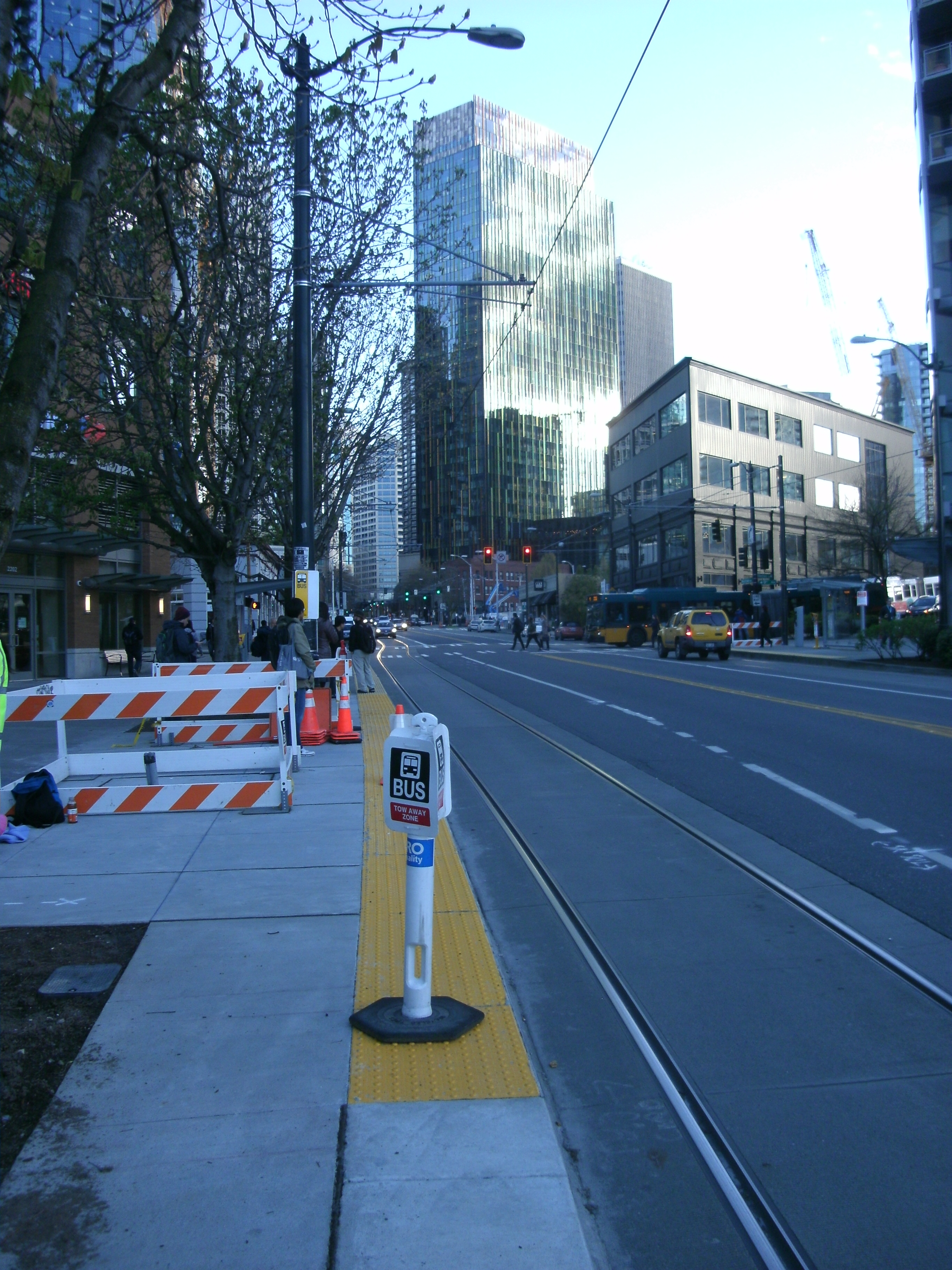
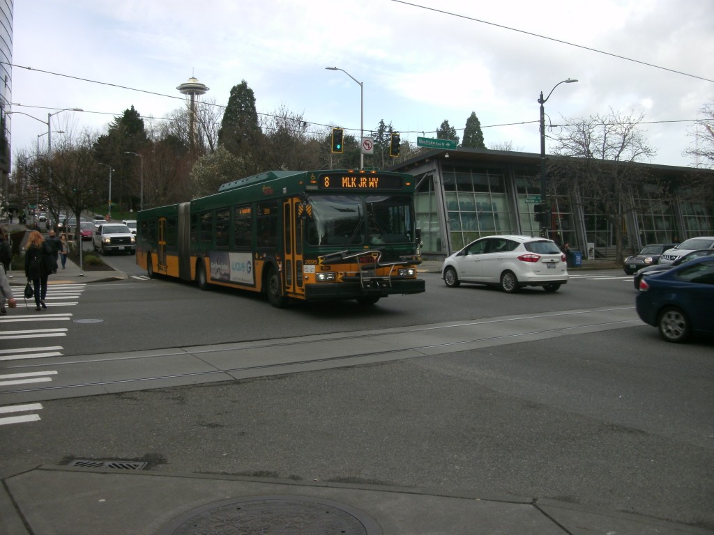
On Monday March 28th, the first weekday of King County Metro’s biggest service change in years, South Lake Union will see a pretty big increase in transit service. The South Lake Union Streetcar will be increased to 10-minute frequency from 7 am to 7 pm. RapidRide route C, with its decoupling from the D line, be extended to terminate near Fred Hutchinson Cancer Research Institute. And the route 40 will move from being on 9th Avenue N southbound to Westlake Avenue N, the street it uses northbound. Westlake Avenue will jump into the ranks of Pine Street and 3rd Avenue in terms of frequency of available transit.
The northbound bus & streetcar stop at Westlake and Denny will see an increase in buses per weekday from 153 to 288 buses serving it. During the 8 a.m. hour, 22 buses will serve that stop, up from only 9. The bus stops that will handle all of these extra double-articulated buses have been enlarged, and the stops themselves have been raised to speed boarding where before the bus might have had to kneel.
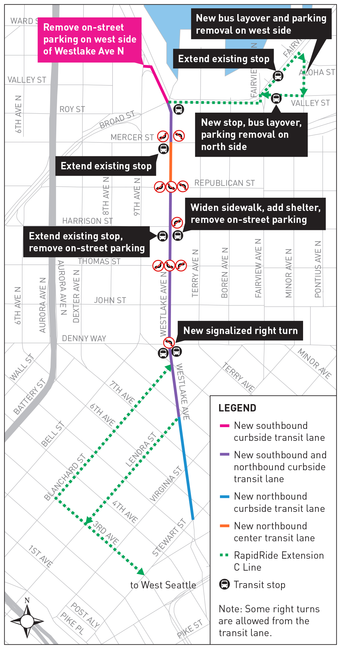
But the centerpiece of the corridor is converting the curb lane on both sides of Westlake Avenue from general purpose to transit only for almost the entire corridor.
Here is SDOT’s graphic showing the changes in the corridor (click to enlarge):
 An investment in South Lake Union transit service on this scale means that our transportation leaders are waking up to the fact that service to the booming northern segment of downtown has been lagging behind service to the downtown core for a while. A 2014 study by Commute Seattle showed that while 31% of downtown workers drive alone to work, in South Lake Union that number was 46%. As much as this may be a reflection on available parking and daytime rates, it is at least partly a reflection on availability of transit service.
However, as changes begin to be implemented along the corridor, transit advocates have become increasingly concerned with the fact of these changes might not go as far as they might to ensure streamlined transit service throughout the corridor.
- Transit lanes will not be painted red. Only signage on the side and above the roadway will indicate to drivers that they might be in a lane that they shouldn’t be in. SDOT has previously published literature demonstrating the effectiveness of painted transit lanes around the world, including this one from Brisbane, Australia: “This resulted in a 60% reduction in cars using the bus lane.” SDOT has already implemented red transit lanes a few streets over on Aurora Ave and in other areas.
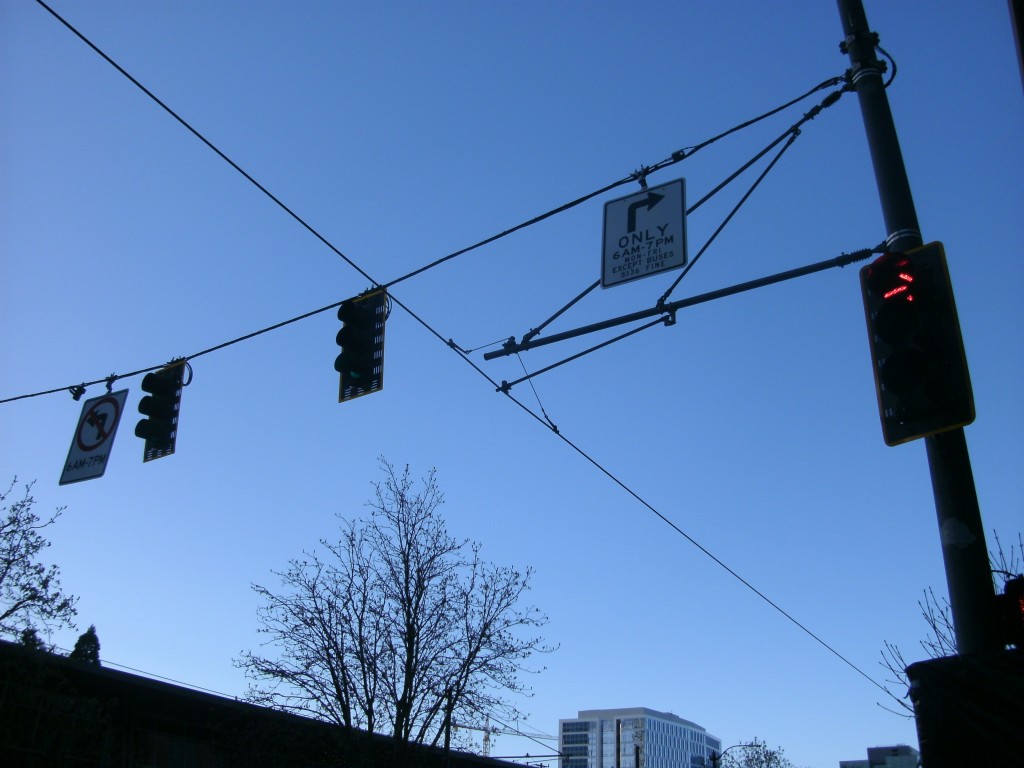
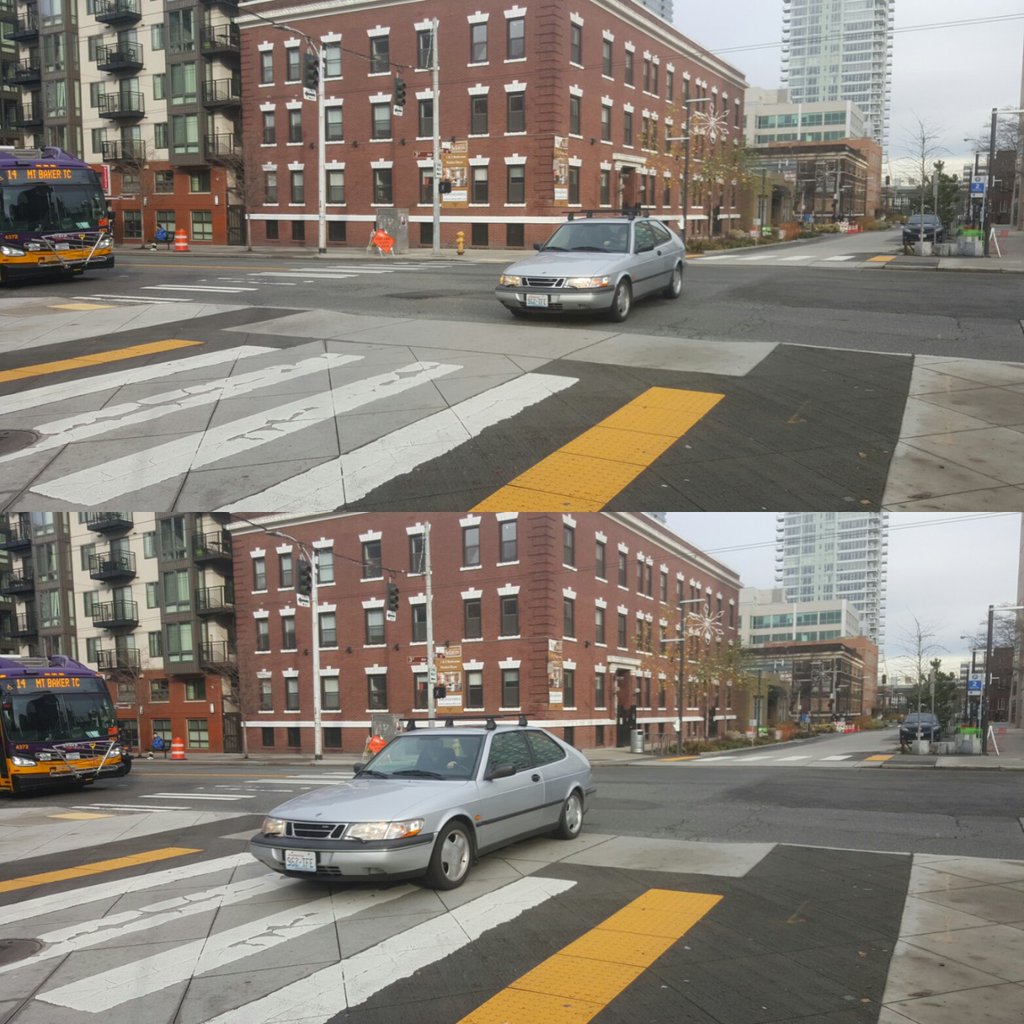
- The signage chosen has proven ineffective in other areas. SDOT passed over the more successful treatment on 3rd Avenue, where travel during the peak is restricted to one block and where there are large DO NOT ENTER signs directly above the roadway where cars are prohibited from continuing through the intersection. Instead, SDOT has chosen the same signage that they have previously chosen on Bell Street to restrict through travel — these are infamously ignored. SDOT does appear to have additional signage on Westlake ready to unveil with the service change, but it’s clear that side-of-the-road signage is not going to be as effective as red lanes or DO NOT ENTER signs over the roadway like on 3rd.
- Forcing right turns in transit lanes makes them less effective. At Denny & Westlake, plans were circulated which showed that SDOT was planning to restrict all right turns from Westlake onto Denny Way eastbound. From a capacity issue, this makes sense: Denny Way is continually overcrowded. Allowing right turns there would require drivers utilize the transit only lane, to try and enter a corridor that is already packed with cars. On weekday evenings, traffic from the next light at Fairview will frequently back up all the way to Westlake. Requiring a right backs up traffic; with no right turn allowed there, drivers would have less of an incentive to be in the transit lane at all.
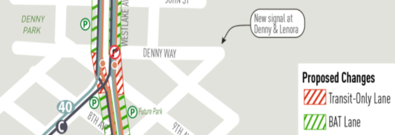
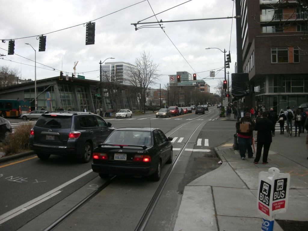
The no-right-turn option at Denny & Westlake. Of course, the main reason drivers use Denny Way is to access I-5. The SDOT plan to accommodate those trips was to instead encourage traffic in the Westlake area to use Lenora Street to get to I-5. But this would have required changing the Denny & Lenora intersection and adding a new signal there. The Urbanist is still waiting to hear from SDOT as to why they did not decide to go that direction.
Instead, they have chosen to install a forced right turn from the right lane northbound on Westlake at Denny. Any buses heading north on Westlake will have to wait for crosswalk traffic to clear and traffic in front of them to make a right before they can proceed through the intersection. A right-turn arrow has been added after the pedestrian cycle, but right turns on red are still legal at the intersection. In other words, a protected turn cycle has been added, but with no accompanying protected phase for pedestrians. Drivers turning right at this intersection can literally turn at any point, no matter the signal phase, across both directions of pedestrian traffic.
This intersection is by far the most heavily trafficked pedestrian intersection in that segment of Denny Way. This document from the planning phase of Amazon’s new buildings in Block 21 shows 475 pedestrians per hour utilize the intersection north/southbound and 340 east/westbound. This number has likely increased since the data was obtained, with the opening of some large Amazon buildings south of Denny, there has certainly been an increase in the amount of pedestrian traffic between the two poles of the campus. The configuration chosen by SDOT does nothing to make pedestrians in the corridor safer.
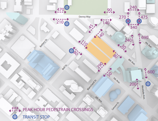
Pedestrian Volumes at Denny Way Intersections (City of Seattle)
- Transit not on Westlake will be slowed by the choices made here.
In looking at the alternatives, SDOT estimated impacts on travel times on transit routes that will not have the benefit of the transit lanes on Westlake. The Metro route on Denny Way, the route 8, was estimated to see a 15% increase in delay at the intersection with the alternative chosen, namely the forced right turn. Service on Dexter would also see a 35% increase but the routes listed by SDOT, the 26 and 28, will be moving to Aurora to be replaced by local service on the new route 62, so it is unclear how those numbers will look after that change.

We have written about plans to help the very infamously unreliable and stuck-in-traffic route 8. These plans are still several years down the road, and it looks as if SDOT has just given the route 8 a serious setback toward reliability on this route. Signals on Denny were retimed recently in conjunction with this project, but dumping more traffic from Westlake onto Denny is only going to hurt the 8.
Investing in transit in South Lake Union deserves to be done thoroughly and effectively. Commuters in the neighborhood might question the idea of adding so much transit service if the infrastructure they were promised is not quite living up to the expectations that were set when the project was announced. At the very least, SDOT should monitor this corridor closely after the service change begins at the end of March and act proactively to make sure that it is doing everything it can to move transit quickly through the area. SLU should not be left with transit infrastructure that is only “good enough”.
Ryan Packer has been writing for The Urbanist since 2015, and currently reports full-time as Contributing Editor. Their beats are transportation, land use, public space, traffic safety, and obscure community meetings. Packer has also reported for other regional outlets including Capitol Hill Seattle, BikePortland, Seattle Met, and PubliCola. They live in the Capitol Hill neighborhood of Seattle.


