
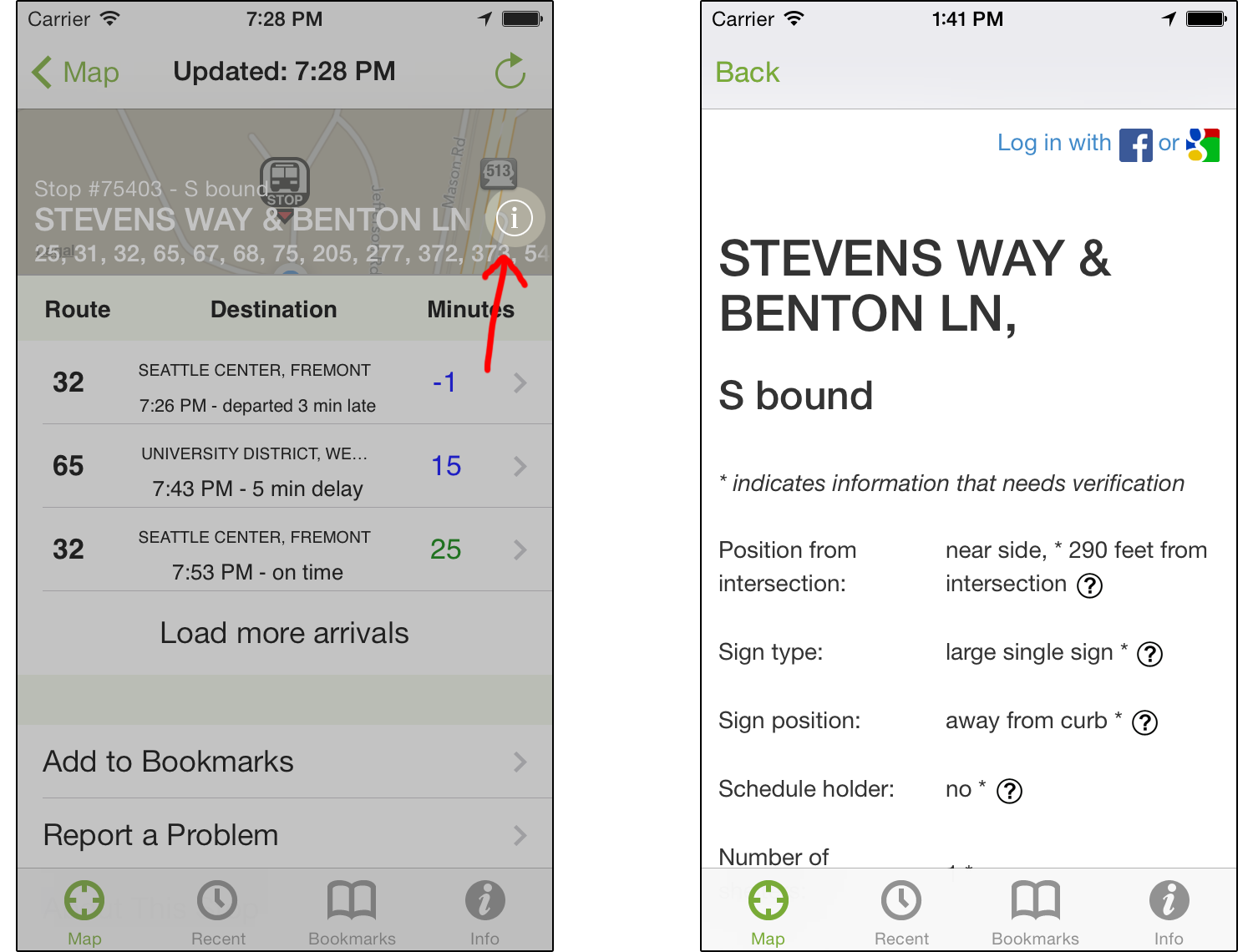

Image: (left) Where to access StopInfo within the OneBusAway iOS Application. (right) StopInfo’s information screen.
Many people rely heavily on visual cues to navigate their environments. In the case of locating transit stops, particularly those in unfamiliar areas, this can involve scanning for the proper sign and identifying other transit-associated landmarks such as shelters or card readers. But for visually impaired transit riders, locating stops is often a challenge. Which corner of the intersection is the stop closest to, and how far down the street is it? Is it located on an island? Is the bus sign close to the curb or away from it?
Having access to this type of information ahead of time or while navigating to the stop can help. This is one of the primary goals of StopInfo, a prototype system that can be found on the Web and in the transit application OneBusAway on the iPhone (see image above). StopInfo presents information such as stop position relative to the intersection, whether there is a bus shelter, what type of sign is present and how far from the curb, as well as what other physical objects (such as trash cans and benches) are around. For visually-impaired pedestrians using a white cane, advance knowledge of what landmarks are present at a certain bus stop can help them know what to search for, while positional information can let them know approximately how far they should expect to travel from the intersection. But this information is not only useful to the visually-impaired. Information such as how well-lit the stop is might help people travel more safely and confidently at night. Displaying whether a stop is temporarily or permanently closed can also be useful for all people using the app.
One of the more novel StopInfo features is how the information itself is collected. While the starting information comes from King County Metro’s database, anyone using OneBusAway on an iPhone or the StopInfo website can add data that Metro doesn’t track. Since the initial launch of StopInfo in late February, we have collected over 1,300 submissions for 845 unique stops in King County. We have also studied the use of the system with six visually-impaired transit riders over a five-week period. We found that StopInfo is generally helpful for blind and low vision riders and that it can promote more spontaneous trips, often to less familiar places. Additionally, all six of our participants said that they wanted to keep using the system even after the study ended. Full details on this study can be found online. The study will be published and presented at the Association for Computing Machinery’s Special Interest Group on Accessible Computing annual conference in October.
We are now in the midst of evaluating the system more fully, and are considering the underlying values associated with it for a full range of stakeholder groups. These groups include transit officials at King County Metro, visually impaired transit riders, bus drivers, and transit riders who might potentially contribute information. So, if you are a Metro driver, a person who is blind or low vision, or are interested in potentially contributing information or have contributed information before, please contact us at stopinfo@onebusaway.org. If you are a OneBusAway user interested in contributing, you can also take a quick online survey, which offers a chance at winning a $50 Amazon gift card in a drawing.
We encourage transit riders in the King County area to submit information about bus stops as they wait for the bus. It’s easy to do by using StopInfo on iPhone or in a mobile browser for other smartphone platforms (we are working on incorporating this feature into other versions of OneBusAway soon). We are also working with Metro on ways to reward our top contributors to the application.
For more information, or if you have questions or comments, you can read our article on StopInfo, contact us at the e-mail address mentioned above, or reply to this post. Thank you!